District 3 – Southwest Idaho
Overview
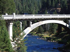 District 3 covers just under 22,000 square miles of southwest Idaho and maintains 2,647 lane miles and 399 bridges. District 3 encompasses the 10 southwest counties, the most roads and bridges of all the districts, and nearly 40 percent of the state’s population.
District headquarters is in Boise located in Ada County, where Jason Brinkman is the District Engineer. Julie DeLorenzo, of Boise, has represented District 3 on the Idaho Transportation Board since March 2012.
District 3 Fax: 208-334-8917
Address: 8150 Chinden Boulevard
Boise, ID 83714-1367

Julie DeLorenzo
Board Member
208-703-4348
News
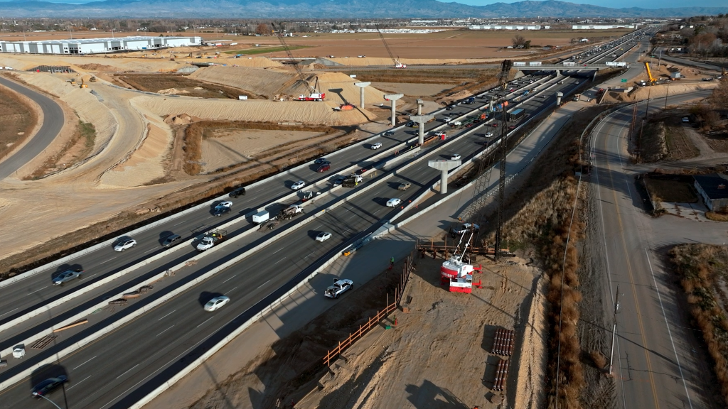
I-84 closes, installs girders, next weekend between Garrity and Ten Mile
SH- 21 to reopen at 5 p.m. with reduced lanes; additional closures planned next week
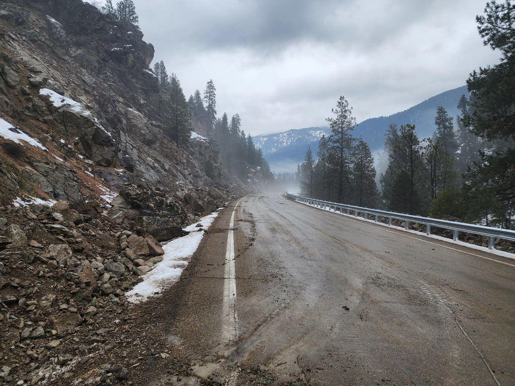
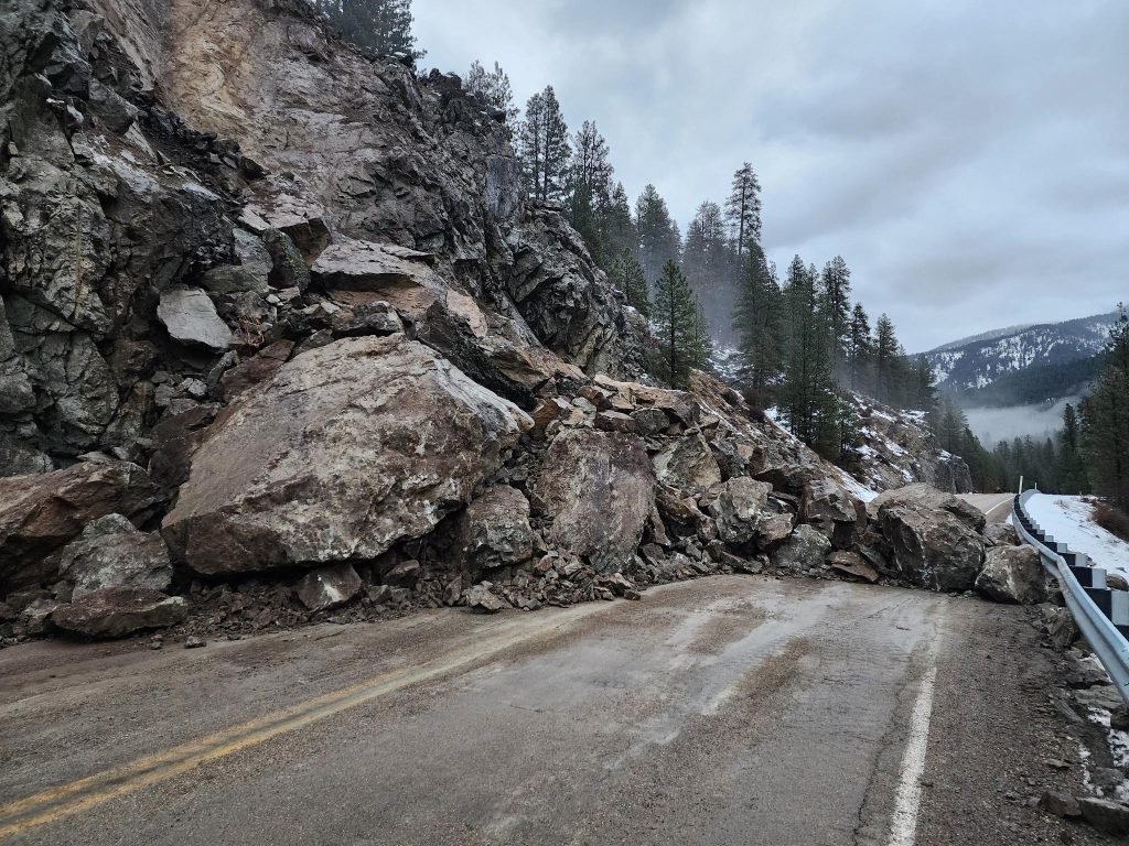
SH-21 between Sourdough and Banner Summit closed after rockslide
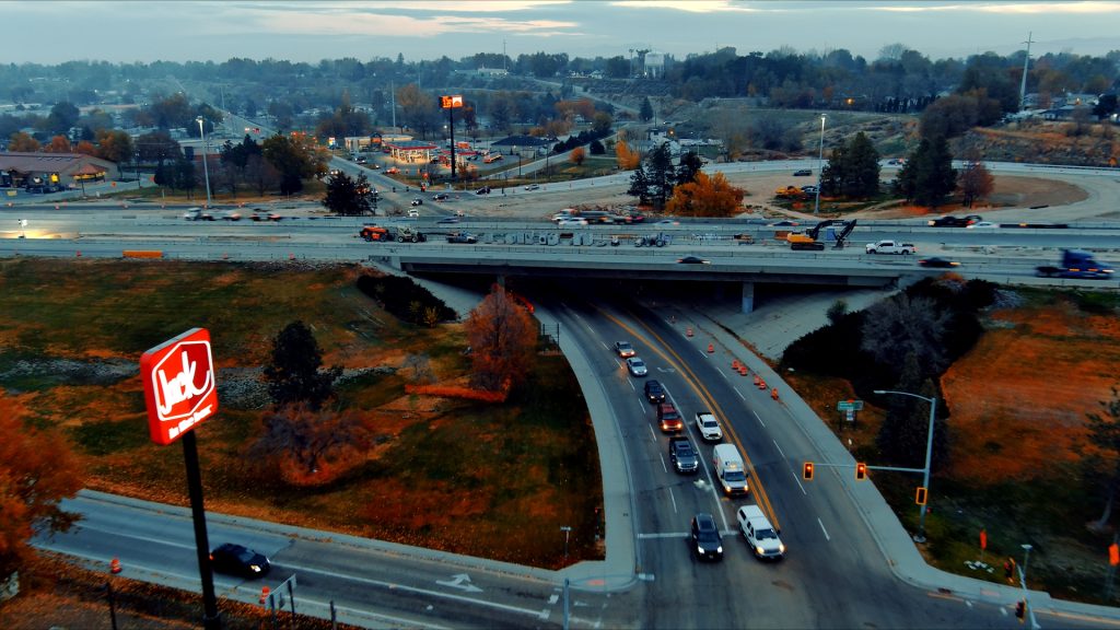
I-84 traffic to shift and 10th Avenue to close intermittently in Caldwell
New traffic pattern begins at SH-16 and SH-44
Karcher Road closed from Montana Avenue to Indiana Avenue this weekend
ITD begins utility locating work for Elijah Drain repair project
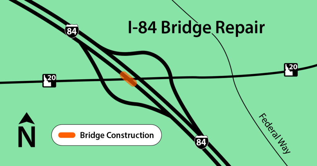
I-84 eastbound lane closure Tuesday at Gowen Road exit for bridge repair work
Construction
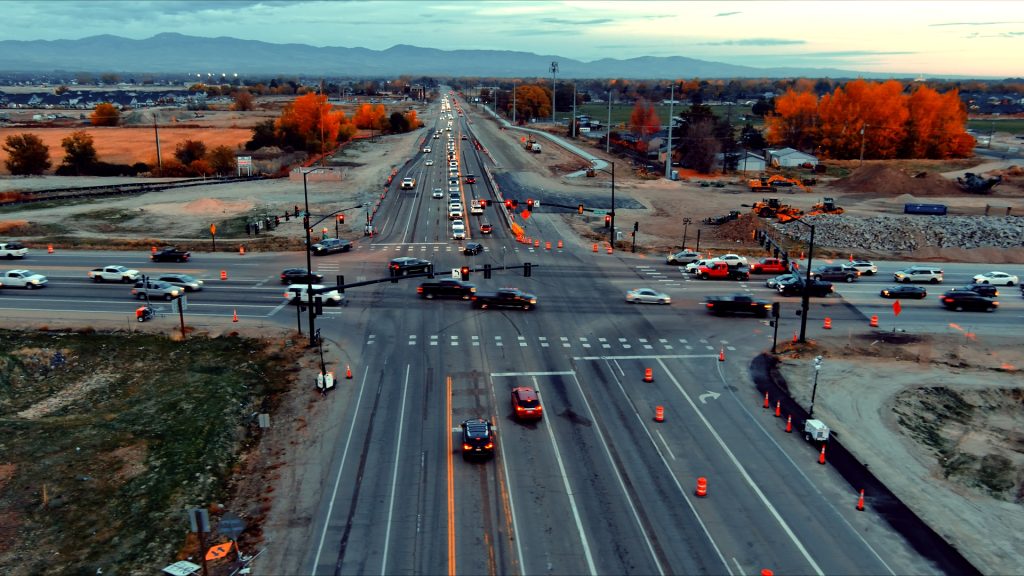
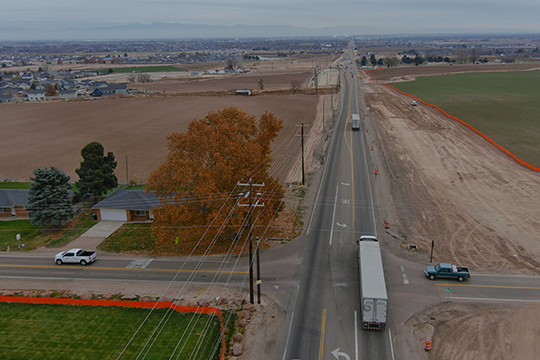
Highway Construction in Southwest Idaho
For more information about projects in construction or planning phases go to: itdprojects.idaho.gov
For construction, road conditions, & cameras go to: 511.idaho.gov
Planning & Design
Projects in Planning or Design Phases
 For more information on ITD project plans & map locations go to: itdprojects.idaho.gov
I-84 Project Corridors
US Routes
State Highways | Idaho Routes
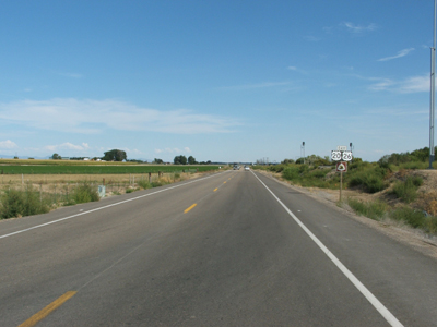
The purpose of the U.S. 20/26 Corridor Study is to develop a medium range (through 2020) plan that identifies current and future highway needs for more than 14 miles of U.S. 20/26 running from I-84 near Caldwell west to Nyssa, Oregon and the Snake River. The highway overlaps U.S. 95 for eight miles from east of Parma to Anderson Corner Road – the corridor study for that section is addressed in the ongoing U.S. 95 Corridor Study. The Corridor Study is being done to comply with Idaho Transportation Department Board policy, which is also consistent with federal planning guidance. The study and subsequent adopted plan will be used to chart U.S. 20/26 road improvements from I-84 to the state line in the Statewide Transportation Improvement Program (STIP).
The completed plan will include:
- A 10-year plan for the corridor.
- Identification of corridor priorities.
- Identification of existing and projected environmental, roadway, and land use conditions.
- Analysis of future travel demand and performance in the corridor.
- Analysis of accidents and recommendation of safety features including access management.
Sample urban and rural cross-sections of the highway will be illustrated. Any projected capacity improvements that require a cross-section different from the current samples will also be illustrated.
Features will include:
- Number of lanes
- Lane width
- Shoulder width
- Side slopes
- Curb, gutter, and sidewalks for urban cross-sections
The National Environmental Policy Act (NEPA) requires that an environmental review be completed before right-of-way can be acquired with federal funds. The U.S. 20/26 Corridor Study is not programmed to recommend or fund purchase of right-of-way. Therefore, ITD will not complete a NEPA-level environmental review. However, an Environmental Scan will be conducted to provide a baseline survey which includes a qualitative analysis of the current human environment. The human environment includes aspects of the natural environment, built environment, and human health. Constraints that may have a limiting factor in roadway width and placement of the highway section will also be identified.
U.S. 20/26 is a major farm-to-market road serving agriculture and quarrying industries in western Canyon County. Cross-state access is directly provided to Nyssa and connecting access is provided via Highway 18 to Adrian, Oregon. The majority of the highway is two-lane rural with a 65 mph speed limit.
Mark Wasdahl, ITD Project Manager
(208) 334-8344 – mark.wasdahl@itd.idaho.gov
The Idaho Transportation Department (ITD) is studying U.S. 95 from the Idaho border in Owyhee County to Pinehurst at the Adams / Idaho County line. The study will result in a corridor plan that identifies important improvement projects over the next 20 years.
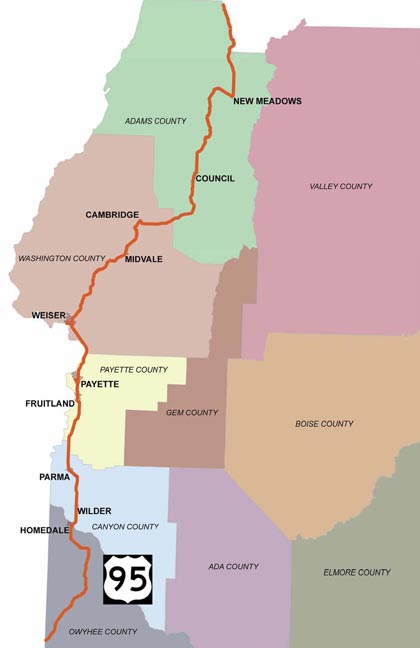
The plan will be published in three parts:
- North: Weiser River to New Meadows
- Central: Nyssa Junction with 20/26 to Weiser River
- South: Oregon State Line to Nyssa Junction with 20/26
U.S. 95 runs north to south through western Idaho. It provides an important north-south international transportation link for long-haul freight between Mexico and Canada.
Within the Idaho Transportation Department’s District 3 boundaries, the highway covers 203 miles from Pinehurst in Adams County to the Oregon stateline south of Marsing in Owyhee County. Recreational travelers and local traffic share the road with long-haul trucks, straining the roadway capacity as surface transportation demand continues to grow.
The completed corridor plan will include an analysis of the existing conditions on the highway; a forecast of future demand over the next 20 years; and a list of short and long-term improvements on how to improve transportation on this section of U.S. 95. The document will address the course of the highway as a whole and on a county by county basis. The plan will be based on community input, engineering analysis, and city, county and agency visions for the future. ITD will include the plan in its Idaho Horizons Long Range Capital Improvement and Preservation Program (LRCIP). LRCIP is a planning document that helps ITD prioritize projects for future years.
The finished corridor plan will address:
- Safety: What are the improvements that will make U.S. 95 safer for motorists, pedestrians and residents?
- Access Management: How can ITD and local communities manage the effect of development along the corridor so the roadway continues to function safely and efficiently?
- Traffic: Can we anticipate congestion points and plan for the best ways to improve traffic flow and capacity throughout the corridor?
- Environment: What are the important environmental issues to consider when ITD seeks to make improvement to U.S. 95 in the future?
· U.S. 95 North Environmental Scan
· U.S. 95 Central Environmental Scan
 The Idaho Transportation Department (ITD) is studying long-term improvements to Idaho 44 from West State Street in Eagle to Interstate 84 in Caldwell.
This study will result in:
- A corridor plan with recommended transportation improvements and the needed right-of-way (land) to support these improvements between now and 2045.
- A Federal Highway Administration (FHWA) Environmental Assessment that outlines how the improvements would impact the environment (i.e., noise, air quality, historic properties, etc.) and how ITD will address the impacts.
- A project phasing plan that identifies and prioritizes individual projects for future funding.
Environmental Process
The FHWA Environmental Assessment (EA) for this project includes several technical studies that address traffic, access management, drainage, noise, air quality, public involvement and other factors. The EA must be approved by the Federal Highway Administration prior to final design and construction. A public hearing will be held in 2019 before the EA is submitted to FHWA.
- Project Documents
Project Background and Schedule
Idaho 44 is the only east-west highway that links Canyon County to Ada County north of the Boise River. As growth and development have increased, ITD is taking a comprehensive approach to address travel time, capacity and safety along this corridor.
Early planning efforts for ID-44 began in 2004 and resulted in a preferred alignment for approximately 16 miles of the corridor. A preferred alignment identifies locations for widening or realigning the roadway in future years. The ID-44 public outreach was a significant component of this early planning process.
ITD’s goal is to complete the ID-44 corridor study in 2019 and immediately begin moving forward with improvements. Public meetings will be scheduled in Ada and Canyon counties later this year.
Contact
Questions or comments about the ID-44 corridor study may be directed to Mark Wasdahl, ITD Project Manager, at mark.wasdahl@itd.idaho.gov or (208) 334-8344.
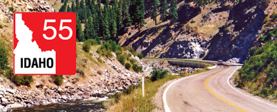 The Idaho Transportation Department (ITD) is studying Idaho 55 to identify current and future needs throughout the corridor. The study will result in three corridor plans (North, Central, South) that identifies policies and projects important to the development of this major arterial over the next 20 years.
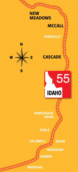
Project Description
The Idaho 55 highway corridor originates 1.7 miles south of Marsing in Owyhee County at the Idaho/Oregon/Nevada junction with U.S. 95 and serves six counties, ending at the junction of U.S. 95 in New Meadows. Most travelers know the highway for its turns along mountain forests, whitewater rapids and favorite recreation spots. The corridor is an important route that supports the regional daily commute, the long-haul trucking industry and recreational traffic.
The completed study will include three separate corridor plans:
- South Corridor Plan – ION Junction in Owyhee County to Interstate 84 in Canyon County
- Central Corridor Plan – State Street in Ada County to Banks Lowman Road in Boise County
- North Corridor Plan – Banks Lowman Road in Boise County to New Meadows in Adams County
Project Materials
North Corridor Plan – January 2016 Meetings
Study Documents
North Corridor Plan
Accessibility | Title VI | Americans with Disabilities Act (ADA) Compliance
The Idaho Transportation Department (ITD) is committed to compliance with Title VI of the Civil Rights Act of 1964 and all related regulations and directives. ITD assures that no person shall on the grounds of race, color, national origin, gender, age, or disability be excluded from participation in, be denied the benefits of, or be otherwise subjected to discrimination under any ITD service, program, or activity. The department also assures that every effort will be made to prevent discrimination through the impacts of its programs, policies, and activities on minority and low-income populations. In addition, the department will take reasonable steps to provide meaningful access to services for persons with Limited English Proficiency.
TTY/TDD Users: Dial 711 or (800) 377-3529 to use Idaho Relay System
Right-of-Way Permits
*NEW* Check it out: Right-of-Way Online Permit Tool
The Right-of-Way (ROW) permit tool is both a guide and an application for completing different types of ROW permits.
- This tool helps you identify the appropriate type of permit.
- Then the tool steps you through the specific process.
- Within the tool are the digital forms to fill out online which expedites the application process.
- Direct links to traditional ITD PDF forms are in the tool as another option.
- The tool also includes Online Payment Portals for each ITD District Office.
- The Payment Portals are always open 24/7.
- Encroachment information & permitting resources are together in this new online tool location.
Remember, you will need to:
- Include all requested plans and details with your completed application form.
- Prepayment is required.
- Include your payment portal receipt with your application.
- Once the completed packet is submitted, allow 30 business days for processing
- After the application is approved, contact ITD Maintenance Foreman at least five days prior to installation for start date approval.
Resources: Encroachment, Utility & Other Permits
This table contains resources for processing requests involving Idaho highway right of way. For additional details, see the “District Submittal” contacts below.
| Permits Quick Links | Resources |
|---|---|
| • Milepoint Logs • iPlan – Mapping tool for Idaho highway route information | • IDAPA 39.03.42 - Governing Rules • Access Management Information • DIG-Line | 811 - Contacts & rules for safe digging • ITD Manuals & Guidance - Complete list |
District Submittal Locations, Details & Contacts
| Regional Locations | Office Hours | Email Contact & District Right-of-Way Resources | Counties & Specific Contacts |
|---|---|---|---|
| North Idaho | District 1 600 W. Prairie Ave Coeur d’Alene, ID 83815 | 7 a.m. to 4 p.m. Pacific Time | Email: D1permits@itd.idaho.gov • District 1 | ROW Permit Quick Reference • District 1 | ROW Permit FAQs • District 1 | Traffic Impact Study FAQs | Counties: Benewah, Bonner, Boundary, Kootenai, Shoshone Phone: 208-772-1297 |
| North-Central Idaho | District 2 2600 Frontage Rd | P.O. Box 837 Lewiston, ID 83501 | 7 a.m. to 4 p.m. Pacific Time | Email: Shane.Niemela@itd.idaho.gov • District 2 | ROW Permit Quick Reference • District 2 | ROW Permit FAQs • District 2 | Traffic Impact Study FAQs | Counties: Clearwater, Idaho, Latah, Lewis, Nez Perce Shane Niemela, 208-799-4239 |
| Southwest Idaho | District 3 8150 Chinden Blvd Boise, ID 83714 | 8 a.m. to 5 p.m. Mountain Time Payments are not accepted after 3 p.m. Payment Phone Line: 208-334-8300, Ext. 2 | Email: ITDD3Permits@itd.idaho.gov • District 3 | ROW Permit Quick Reference • District 3 | ROW Permit FAQs • District 3 | Traffic Impact Study FAQs | Counties: Ada, Adams, Boise, Canyon, Elmore, Gem, Owyhee, Payette, Washington, Valley • Approach & Commercial Permits: Josh Nopens, 208-332-7190 • Utility, Special Event & Other Encroachment Permits: Shona Tonkin, 208-334-8341 |
| South-Central Idaho | District 4 216 S. Date St Shoshone, ID 83352 | 8 a.m. to 5 p.m. Mountain Time | Email: MaryEllen.Russell@itd.idaho.gov • District 4 | ROW Permit Quick Reference • District 4 | ROW Permit FAQs • District 4 | Traffic Impact Study FAQs | Counties: Blaine, Camas, Cassia, Gooding, Jerome, Lincoln, Minidoka, Twin Falls Mary Ellen Russell, 208-886-7839 |
| Southeast Idaho | District 5 5151 S. 5th Ave Pocatello, ID 83205 | 8 a.m. to 5 p.m. Mountain Time | Email: D5EncroachmentPermits@itd.idaho.gov • District 5 | ROW Permit Quick Reference • District 5 | ROW Permit FAQs • District 5 | Traffic Impact Study FAQs | Counties: Bannock, Bear Lake, Bingham, Caribou, Franklin, Oneida, Power Phone: 208-239-3300 |
| East Idaho | District 6 206 N. Yellowstone Ave Rigby, ID 83442 | 8 a.m. to 5 p.m. Mountain Time | Email: Jeffrey.Rawson@itd.idaho.gov • District 6 | ROW Permit Quick Reference • District 6 | ROW Permit FAQs • District 6 | Traffic Impact Study FAQs | Counties: Bonneville, Butte, Clark, Custer, Fremont, Jefferson, Lemhi, Teton, Madison Jeffrey Rawson, 208-745-5605 |
Roadway Sign Request Contacts
Truck Routes
DMV Ports of Entry, Freight Maps & Trip Permits
For all Motor Carrier Trucking Route Maps in Idaho go to the ITRPS website at:
Then click “Helpful Links” in the top left corner of the banner to access maps & attachments for the following:
- Idaho Maps for Approved Routes Up to 129,000 lbs. (129K)
- 129K State Route Maps (by District/Region)
- County Maps for Special Permit & Requirements
- Vertical Clearance Maps | Pilot/Escort Requirements
- Route Capacity Maps
- Route Capacity Maps (by Color)
Contacts
Idaho Transportation Department, District 3 Office
Address: 8150 Chinden Boulevard, Boise, ID 83714-1367
District 3 Phone: 208-334-8300
District 3 Fax: 208-334-8917
Media Contact: Jill Youmans | 208-334-8303
Accessibility | Title VI | Americans with Disabilities Act (ADA) Compliance
The Idaho Transportation Department (ITD) is committed to compliance with Title VI of the Civil Rights Act of 1964 and all related regulations and directives. ITD assures that no person shall on the grounds of race, color, national origin, gender, age, or disability be excluded from participation in, be denied the benefits of, or be otherwise subjected to discrimination under any ITD service, program, or activity. The department also assures that every effort will be made to prevent discrimination through the impacts of its programs, policies, and activities on minority and low-income populations. In addition, the department will take reasonable steps to provide meaningful access to services for persons with Limited English Proficiency.
TTY/TDD Users: Dial 711 or (800) 377-3529 to use Idaho Relay System


