Cultural resources are the physical evidence or place of past human activity. They can include everything from archaeological sites to buildings, bridges, and canals to landscapes and places of traditional religious and cultural importance. ITD seeks to avoid, minimize, or mitigate adverse impacts to historically significant cultural resources.
Archaeology
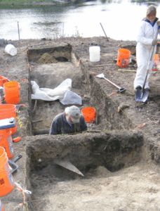
Archaeology is the study of past human activity through the recovery and analysis of material culture. The archaeological record consists of artifacts, ecofacts, features, and cultural landscapes which have been used by people of the pasts.
Archaeologists precisely record where all the clues of the past are found so they may reconstruct living surfaces, which may include house remains, fire-hearths, and refuse or garbage pits. Once the artifacts and their contexts are fully studied, researchers attempt to explain how past peoples and societies made a living and adjusted to changing social and environmental circumstances. Here are some examples of archaeological resources that ITD projects might encounter:
- Artifacts: stone tools, bone, ceramics, glass, and metals
- Ecofacts: animal bones, charcoal, plants, and pollen
- Features: fire hearths, refuse areas/trash dumps, rock art
Once an archaeological site has been identified, archaeologists use the National Register of Historic Places criteria to determine if it the property has historic significance and can still convey it. Archaeologists determine if the property is associated with an important historic event or if it can yield more information about the past. Archaeologists complete a detailed recording of the site, document the site using photography and sketch maps, and conduct in-depth analysis of any artifacts, ecofacts, and features that are present to better understand how these were used by people of the past. ITD uses archaeologists to document sites that might be impacted by projects, determine if they have significance, and assess what impacts project actions might have on those properties.
Society for Historical Archaeology (SHA): ITD receives the Award of Merit for the Sandpoint Archaeology Project
Architectural History
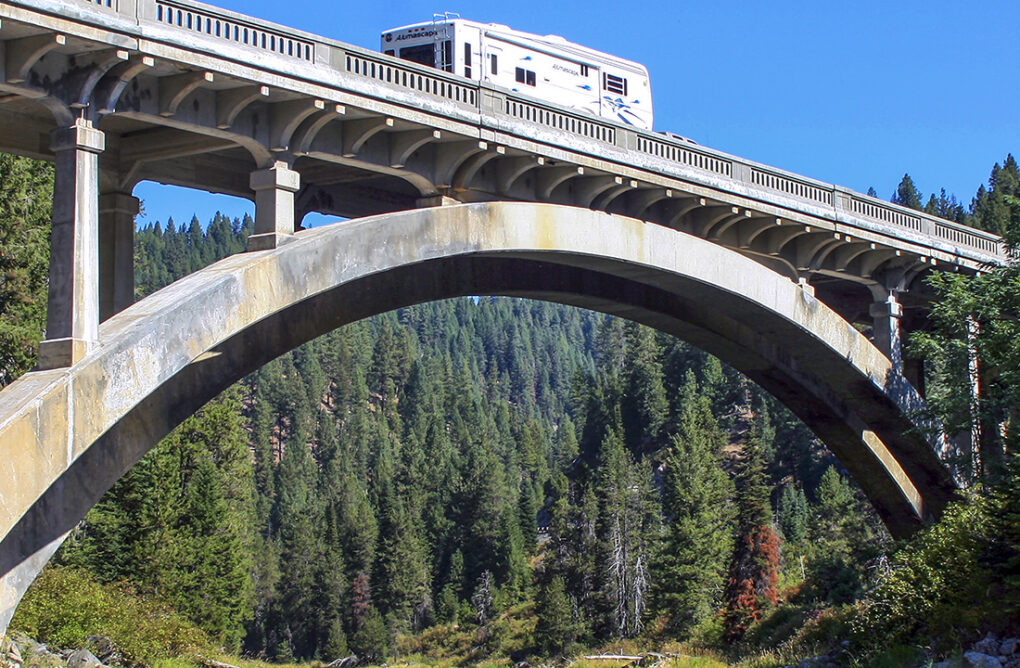
Architectural history is the study of the built environment and how surroundings can impact our lives. Certain properties remind us of our history and shared past. Here are some examples of architectural resources that ITD projects might encounter:
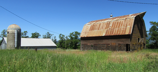
- Buildings: private residences, commercial properties, barns, schools, and courthouses
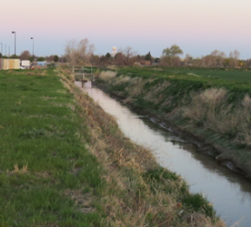
- Structures: bridges, roads, and irrigation canals
- Objects: monuments and boundary markers
- Sites: parks and cemeteries
- Districts: downtown Main Streets and residential neighborhoods
Once an architectural resource has been identified, architectural historians use the National Register of Historic Places criteria to determine if it the property has historic significance and still has the physical features necessary to convey that significance. Usually these properties are at least fifty years old. Architectural historians determine if the property is associated with an important historic event or person; has a distinctive design, style, or construction; or if it can yield more information on the past. They also ask if the location, design, setting, materials, workmanship, association, and feeling of the property helps that property convey its significance to the general public. Architectural historians complete detailed written descriptions of the property, document the property using photography and sketch maps, and conduct in-depth archival research to better understand the local, state, or national significance of the property. ITD employs architectural historians to document properties that might be impacted by projects, determine if they have significance, and assess what impacts project actions might have on those properties.
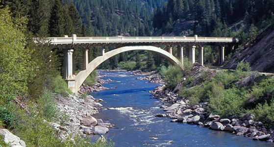
In 2008, ITD was awarded the Excellence in Historic Preservation award from Preservation Idaho for their work on the Idaho 55 Rainbow Bridge.
ITD projects with federal funding, permitting, or land are required by Section 106 of the National Historic Preservation Act of 1966, and implementing regulations 36 CFR 800 to take into account the effects of project actions on historic properties. During this process ITD Cultural Resources staff define the Area of Potential Effect, make a good and reasonable faith effort to identify historic properties within that area, and assess any potential effects of the project on those properties. This process is completed in consultation with the Idaho State Historic Preservation Officer (SHPO), Tribal Historic Preservation Officers (THPO), Native American Tribes, local historic preservation commissions, and other interested parties.
For more information on the ITD Section 106 process, please refer to the Cultural Resources chapter of the Environmental Procedures Manual.
Those ITD projects with funding or approval from the Federal Highway Administration must also meet requirements of Section 4(f) of the Department of Transportation Act of 1966. Please see the Section 4(f) chapter of the Environmental Procedures Manual for more information on this process.
Historic Survey of Roads in IdahoΓÇÖs State Highway System
This multi-volume publication illuminates the history and evolution of IdahoΓÇÖs highway transportation network. These volumes have been developed as a way for the public and consultants to better understand the history surrounding IdahoΓÇÖs state highway network, the individual highways, and to provide a consistent interpretation in applying National Register of Historic Places (NRHP) criteria to evaluate the significance, integrity, and eligibility of the current roads within this road system.
Volume 1 is the Historic Context and Volume 2 is the Application of the National Register of Historic Places Criteria for Evaluation. Volume 3, currently in development, will document individual highways and their specific history and assess their NRHP eligibility.
- Volume 1 ΓÇô Historic Survey of Roads in IdahoΓÇÖs State Highway System: Historic Context
- Volume 2 ΓÇô Historic Survey of Roads in IdahoΓÇÖs State Highway System: Application of the National Register of Historic Places Criteria for Evaluation
Idaho is a geographically, economically, and culturally diverse state. Our transportation system represents the shared history that helps to unite us. ITD has worked with consultants and local communities to prepare informative publications and resources about transportation history in the Gem State.
- The Weiser River Trail: To the Golden Heart of Idaho – This pamphlet summarizes the history of the Pacific and Idaho Northern Railroad and Weiser River Trail, Idaho’s Longest Rail-Trail, located in Adams and Washington Counties.
- Blaine County Transportation: A History of Bridges and Roadways in Blaine County, Idaho – This document identifies historic vehicular bridges in Blaine County and how these resources relate to the historic transportation infrastructure in the central Idaho.
- Marsing Oral History Project | “No Bridge, No Town” – Oral Histories on the Historic Snake River Bridge and the Town of Marsing: Agreed upon as an appropriate mitigation for the adverse effect to the historic Snake River Bridge near Marsing, Idaho, these interviews were conducted by the Owyhee County Historic Preservation Commission to preserve both the history of the bridge and life in early twentieth century Marsing.
- Idaho Transportation Photo Collection: This collection of over 30,000 images documents the rich history of transportation and infrastructure development in Idaho. The online, searchable database is free to the public.
- IdahoΓÇÖs Highway History 1863-1975: Written in 1985 this document provides a brief synopsis of transportation in Idaho, including the history of the Idaho Transportation Department.
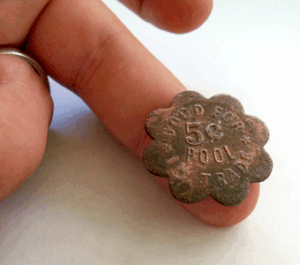
- The Other Side of Sandpoint ΓÇô Early History and Archaeology Beside the Tracks: The Sandpoint Archaeology Project (2006-2013) was one of the largest historic archaeology projects in the western United States, and the largest archaeology project ever completed in the state of Idaho. It resulted in the recovery of over 600,000 artifacts associated with the early history of Sandpoint, Bonner County, Idaho. The four volumes include:
- Sandpoint Stories
- Material Culture of Everyday Life
- The Ethnography and Prehistory of Sandpoint (upon request), and
- Summary of Methods and Data
- Research Guide on Snake River Ferries: This document captures the history of ferry crossings and pioneer travel throughout IdahoΓÇÖs Snake River region, including links to additional research materials on ferry crossings.
- US-95, Meadows Valley Transportation Corridor: Learn about the history of transportation routes and modes connecting Meadows Valley to Riggins.
- Steel Bridges in Eastern Idaho: Once commonplace but now rare, steel bridges in eastern Idaho heavily influenced the development and settlement of the region.
- History of Grace Dam Power Plant: One of three hydroelectric power plants in Caribou County, the Grace Dam Complex ΓÇô including the dam, power plants, and penstocks ΓÇô was built in 1906 and is still operational today, providing power to southern Idaho and northern Utah.
- From Forest to Field – Agriculture in Bonner County: Developed as mitigation for the adverse effect to a farmstead, this document is a detailed look at the agricultural industry in Bonner County. Visit the Bonner County History Museum to see this material on exhibit.
ITD has worked with local communities and historians to develop and install interpretative panels throughout the state.
Here are some interpretive signs you can see during your travels.
- Located about a half mile north of Grace, Caribou County, Idaho just on State Highway 34, are a handful of interpretive signs on the history of the Grace Dam Power Plant. Two, developed by ITD and the Local Highway Technical Assistance Council, share the history of the Turner Road Penstock Bridge and L.L. Nunn, the builder of the Grace Dam Power Plant.
- Located at the Rotary Park in McCall, Valley County, Idaho off of State Highway 55, are two signs about the history of the Lardo Bridge Crossing and Charles A. Kyle, one of Idaho’s most influential bridge engineers.
- Located on the south remnant of the Kootenai River Bridge in Bonners Ferry is an interpretive sign on Kootenai River crossings. Also in Bonners Ferry, installed near Bonners Ferry City Hall and in the vicinity of the Fairbanks Morris Generator, are two signs on the history of power and electricity in the region.
- Located along the Boise Greenbelt near Broadway Bridge in Boise, Ada County are multiple interpretive panels telling the history of crossing the Boise River and how it has impacted development and settlement. Thank you to the Boise City Department of Arts & History for providing these images.
- Located at the intersection of Railroad Avenue and Bridge Street in Sandpoint, Bonner County, are two signs documenting the history of the Northern Pacific Railroad in northern Idaho and its impact on the community of Sandpoint.
- Located at the Horseshoe Park in New Plymouth, Idaho along the route of US Highway 30, are six signs about the history of the William E. Smythe, the founding of New Plymouth, irrigation in the Payette Valley, and individuals important to the history of New Plymouth.
Once an archaeological site has been identified, archaeologists use the National Register of Historic Places criteria to determine if it the property has historic significance and can still convey it. Archaeologists determine if the property is associated with an important historic event or if it can yield more information about the past. Archaeologists complete a detailed recording of the site, document the site using photography and sketch maps, and conduct in-depth analysis of any artifacts, ecofacts, and features that are present to better understand how these were used by people of the past. ITD uses archaeologists to document sites that might be impacted by projects, determine if they have significance, and assess what impacts project actions might have on those properties.
Society for Historical Archaeology (SHA): ITD receives the Award of Merit for the Sandpoint Archaeology Project
Once an architectural resource has been identified, architectural historians use the National Register of Historic Places criteria to determine if it the property has historic significance and still has the physical features necessary to convey that significance.Once an architectural resource has been identified, architectural historians use the National Register of Historic Places criteria to determine if it the property has historic significance and still has the physical features necessary to convey that significance.