Overview
The large majority of traffic on Interstate 15 through Idaho Falls exits at U.S. Highway 20. This is the primary route that connects East Idaho and takes visitors to the western entrance of Yellowstone National Park. Since 2018, we’ve been working with the city of Idaho Falls, Bonneville County and other cooperating agencies to develop alternatives that will accommodate future growth projections and increase safety and mobility.
Many public meetings have been held since then, with 29 different alternatives originally being developed based on feedback. An Environmental Impact Statement is now being completed that has narrowed those options down to two viable alternatives. The completion of the EIS process will determine which will ultimately be built to serve eastern Idaho for many, many years to come. Construction of this project is currently unfunded, with budget yet to be determined as that phase gets closer.
Interstate 15 and US-20 in Idaho Falls
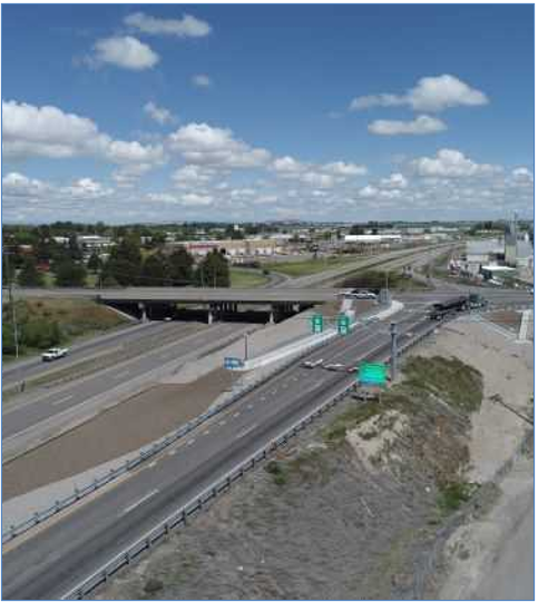
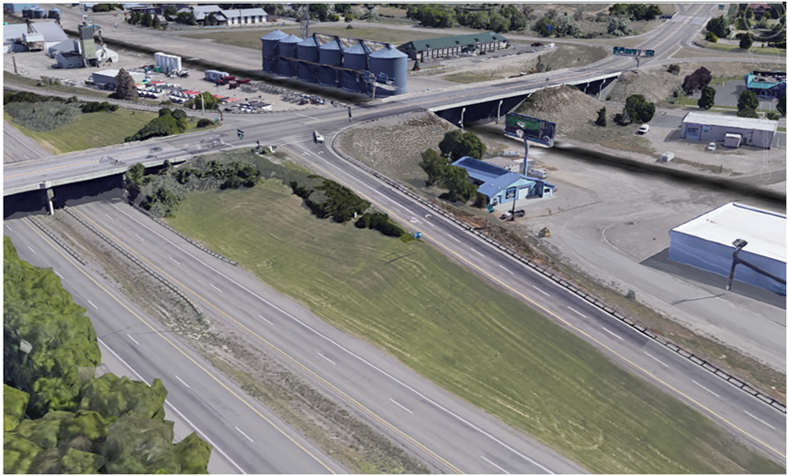
More than 80% of Interstate 15 northbound traffic takes Idaho Falls Exit 119 onto U.S. Highway 20. This route provides important connections to the City of Idaho Falls, Bonneville County, and the East Idaho region. US-20 is also the primary route to the western access of Yellowstone National Park.
The Idaho Transportation Department (ITD), in coordination with the Federal Highway Administration (FHWA), is conducting an Environmental Impact Statement (EIS) to evaluate potential improvements to provide safe and reliable travel between and along I-15 and US-20, a project commonly known as the I-15/US-20 Connector. The study area is in Idaho Falls and Bonneville County, Idaho.
Purpose and Need
The purpose of the I-15/US-20 Connector project is to address safety, congestion, mobility, and travel time reliability for efficient movement of people, goods, and services on I-15 and US-20 in or near Bonneville County and Idaho Falls.
The needs for the project are related to multimodal and capacity improvements to I-15 and US-20 to address safety concerns on I-15 and US-20; reduce congestion at the I-15/US-20 interchanges; provide pedestrian and bicycle mobility within and across the I-15 and US-20 corridors; and address future travel demand.
Improvements are necessary to address the following needs: unsafe travel conditions caused by substandard weave/merge distances, unacceptable level of service at signalized ramp terminals, and poor pedestrian and bicycle mobility along and across the corridors.
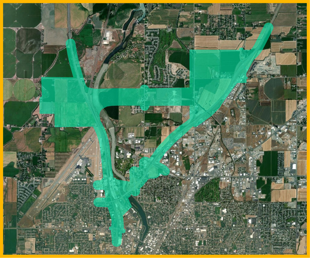
Project Study Area
The project area of potential impact encompasses the alignments of both build alternatives and will serve as the basis for alternatives evaluation in the EIS. Specific areas of potential impact may be established for individual resources.
Community Input
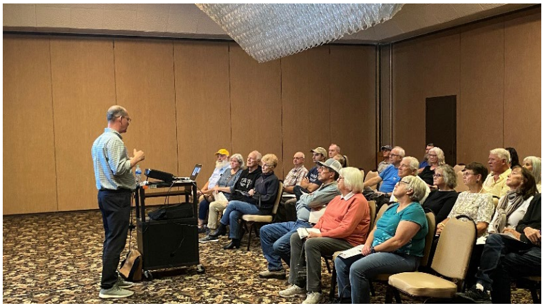
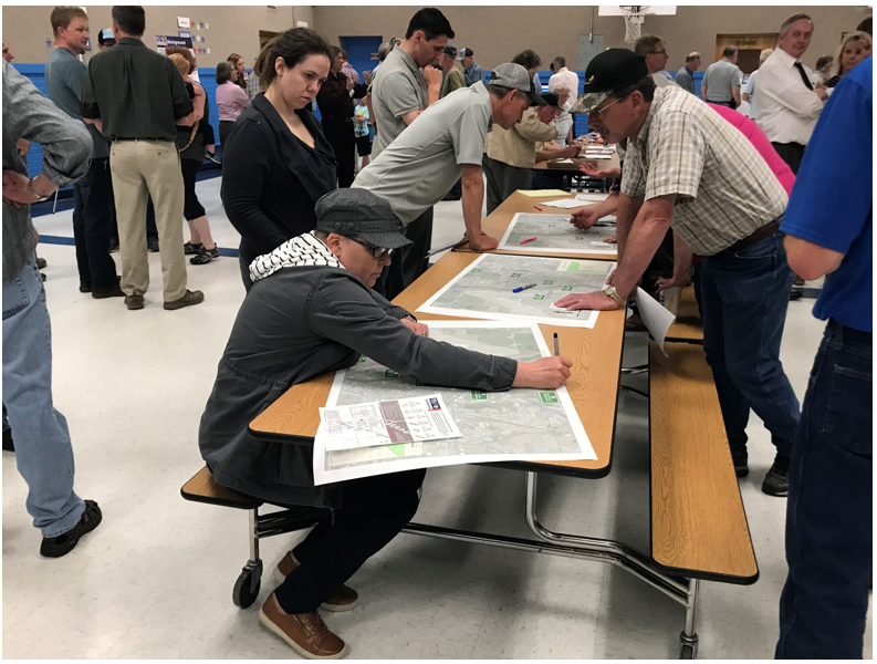
Since 2018, public meetings, community working group meetings and many informal pop-up style meetings have been held to get input from the eastern Idaho community.
This project originally included 29 different alternatives, which have now been narrowed down to two thanks to public input and further study.
As the draft EIS is completed and released, a public hearing will be held. It’s anticipated this will be in 2026.
ITD and all cooperating agencies are appreciative of the high level of community interest and involvement in helping to make this large-scale project a positive change for eastern Idaho and all visiting travelers.
Submit a comment
If you have a comment or question, please complete the general comment form by clicking on the button below.
Timeline
-
August 2018
Planning and Environmental Linkages study officially began- the first of it’s kind for Idaho!
Public meetings were hosted in May and again in September.
-
2019
August Public Meeting
Technical & environmental work
Screening of alternatives based on public feedback and further environmental study
-
2020-2021
September 2020 Public Meeting
Further study and screening of alternatives
PEL document completed August 2021
-
2022
NEPA process officially begins
October 2022 EIS Public Scoping Meeting
-
2023-2024
Interagency meetings and review further completed
January 2023 Community Working Group meeting
Enhanced environmental studies based on NEPA requirements and recommendations conducted
-
2026
Draft EIS document anticipated to be released and a Public Hearing will be held.
Frequently Asked Questions
Many factors go into the determination. Generally, the preferred alternative is the one that provides the best balance between meeting the project needs and minimizing impacts to the human and natural environment. Identification of the preferred alternative will be made based on the engineering and environmental analyses. While public involvement and input is one consideration, identification of the preferred alternative is not a vote.
The NEPA process is governed by federal law and requires consideration and disclosure of potential impacts through a process that includes public involvement and agency coordination. These activities take time. Several requirements of the Environmental Review process recently changed and we will be expediting the process where possible.
The NEPA process involves analyzing how each alternative could affect the human and natural environment.
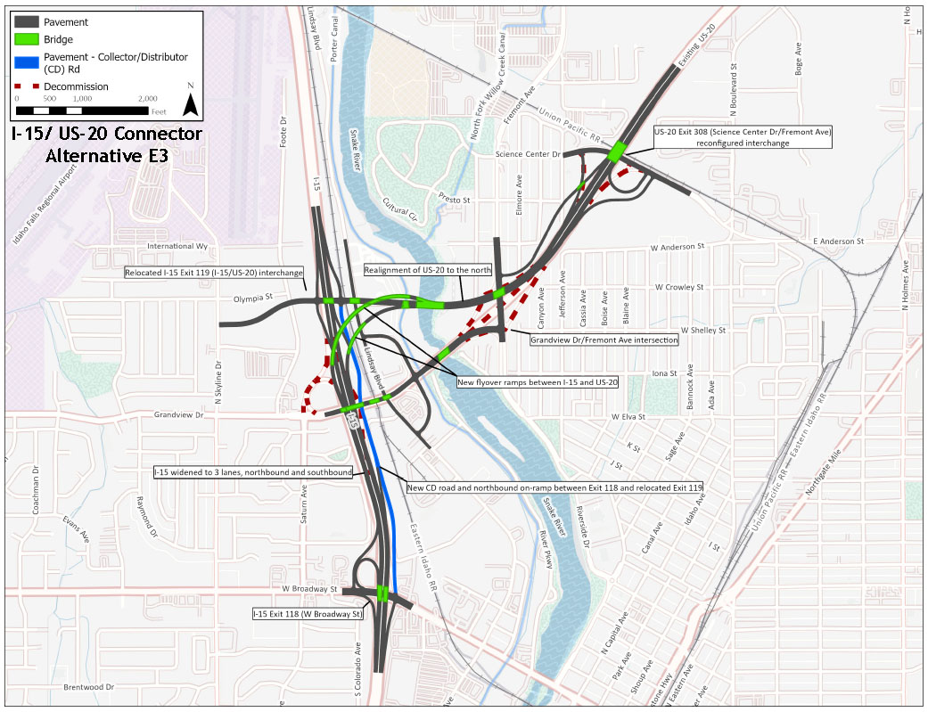
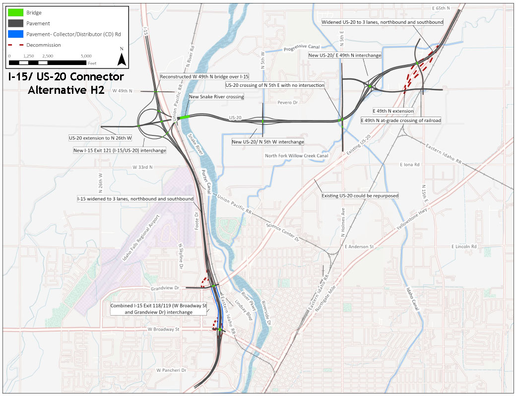
- For Alternative E3, there is likely less flexibility in moving the alignment because of existing infrastructure. Those homes and businesses shown as impacted in the concept graphics are not anticipated to change.
- For Alternative H2, the location currently shown is approximate and will be refined. Those homes and businesses shown as impacted in the concept graphics may change.