Good to Know...
This study is looking ahead to the year 2050 and beyond. Construction is not currently funded and would be done in parts, over time based on the greatest safety concerns when funds are available. The Idaho Transportation Department proposes expanding to four lanes with interchanges or wide medians throughout the corridor, with specific improvements varying by location and more details given within this site.
Overview
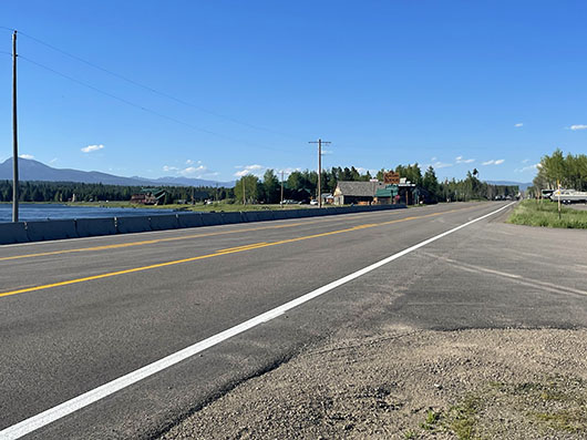
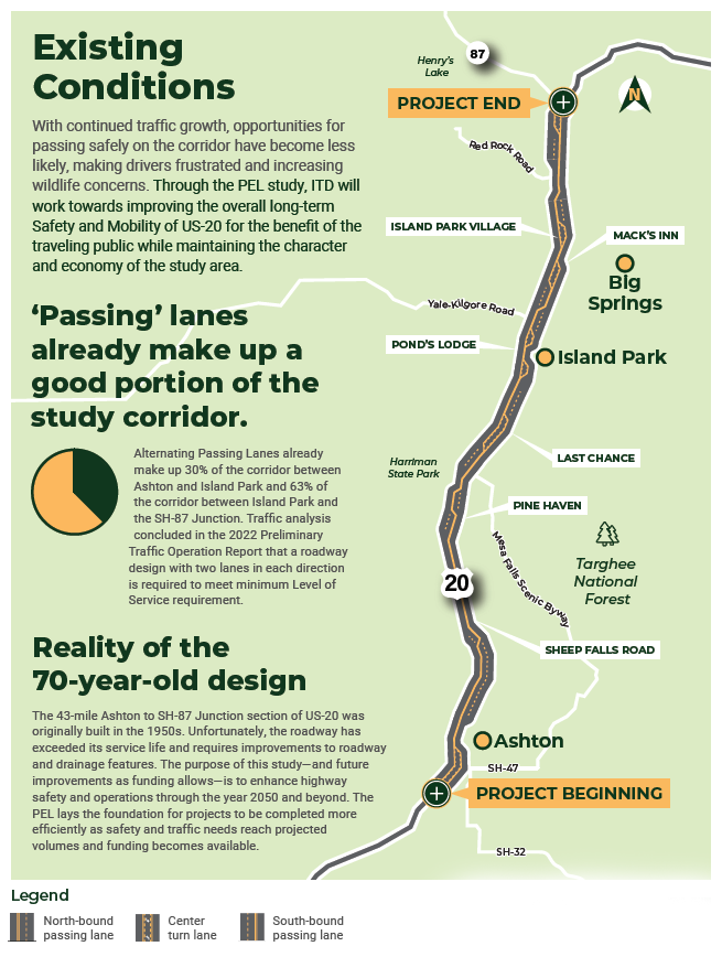
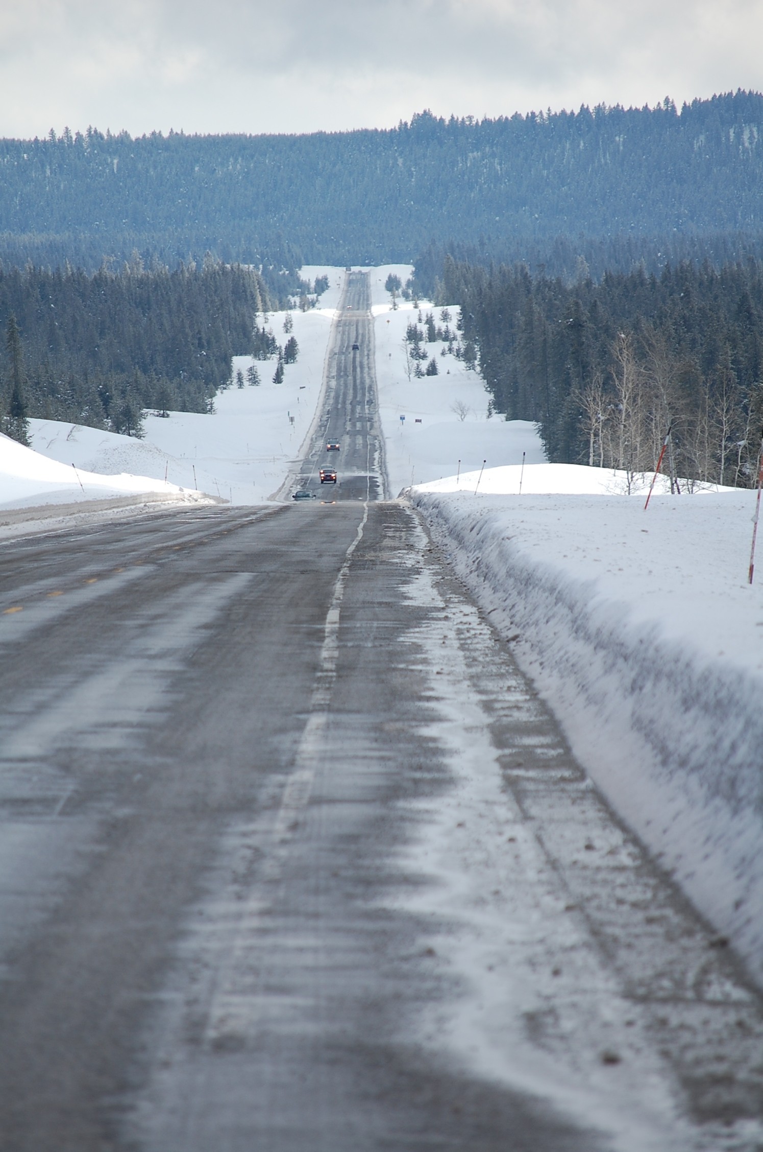
Improvements have consistently been made over time to U.S. Highway 20 from Ashton to the junction of State Highway 87 near the Montana border. Recommendations of older studies and concerns heard from the public have been put into place—things like passing lanes, traffic signals, tree removal, rumble strips and more. Passing lanes through this Island Park corridor of US-20 give some options to help with safety now, but they won’t be enough in the future. Studied improvements will only be implemented after further environmental analysis, and if or when predicted growth and traffic projections are closer to becoming reality.
US-20 Island Park Corridor Planning and Environmental Linkages Study
If we didn’t plan for the future, what would it look like?
Generations before us studied and laid the groundwork for Idaho’s roads to handle growth and be what they are now. It’s time for us to do the same for future generations through the Island Park corridor of U.S. Highway 20.
Passing lanes from Ashton to State Highway 87 near the Montana border give some options to help with safety now, but they won’t be enough in the future.
This study’s proposed improvements do vary by location, and the Idaho Transportation Department proposes expanding to four lanes with interchanges or wide medians throughout the corridor.
This will only be implemented after further environmental analysis, and if or when predicted growth and traffic projections are closer to becoming reality. The US-20 Ashton to SH-87 Preliminary and Environmental Linkages (PEL) study is looking ahead to the year 2050 and beyond. Construction is not currently funded and would be done in parts, over time based on the greatest safety concerns when funds are available.
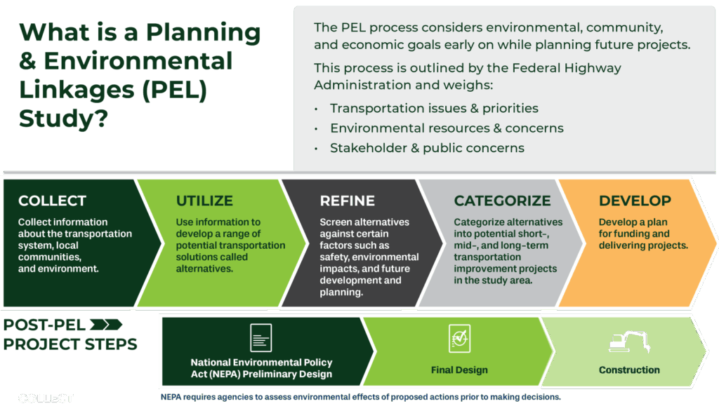
A PEL study starts before the steps of the federally required National Environmental Policy Act (NEPA) begin. It’s intended to help make the time involved in environmental planning as efficient as possible. For any project that ITD undertakes from large to small, NEPA guidelines must be followed. Larger scale projects have a greater impact on the surrounding area and involve more NEPA documentation, coordination, effort and time. During a PEL, alternatives are looked at in detail and screened to find the ones that should be moved forward for even further consideration in the official NEPA process. Public input is a big part of a PEL study and helps us know how we can make the project what it needs to be to serve Idaho.
The US-20 Ashton to SH-87 PEL is studying the 40-mile corridor through Island Park. Because this is a long stretch of roadway, it’s been broken into sections, or “reaches” based on the geography of the area. Nine different reaches are part of this PEL, click on each to learn more:
- Ashton to Caldera Rim
- Pine Haven
- Last Chance
- Ponds Lodge
- Elk Creek
- Macks Inn
- Island Park Village
- Red Rock Road
- Valley View Area
The study’s proposed improvements do vary by location, and the Idaho Transportation Department proposes expanding to four lanes with interchanges or wide medians throughout the corridor.
Timeline
-
2016
Updated existing Island Park Corridor Plan
-
2019
Three projects conducted to improve Island Park corridor, including hazardous tree removal, rumble strips and road widening
-
2021
Initiated and officially began the Preliminary Environmental Linkages study
October- First public meeting
December- Alternatives Workshops with stakeholders (local leaders, business and landowners). 59 Alternatives suggested and studied thanks to these meetings
December to February 2022- Level one screening – the part of the process that refines alternatives based on safety, environmental impacts and more
-
2022
May- Level two screening
June- Public meeting held
-
2023
August- Public meeting held and first Level three screening conducted
2023 to mid 2024- Focus on increased public outreach to better understand concerns of the Ashton, Island Park and Fremont County areas. ITD attended many meetings and made contacts with leaders, business owners, community groups and anyone interested in or potentially affected by proposed future improvements to US-20.
-
2024
June- Additional level three screening conducted, alternatives screened against purpose and need, and viability for each of the nine reaches of the PEL study
August- Public meetings held in Ashton and Island Park
-
2025-2026
March 2025- Design plans for suggested interim safety project to install a traffic signal at Elk Creek, the intersection of US-20 and Yale-Kilgore Road, finalized. Installation/ construction expected in the spring of 2026.
2026- Final PEL study document expected to be complete
-
Future Outlook- 2050 and beyond
Design and construction has not been funded on any of the alternatives that are involved in the PEL study, which is focused on data and growth projections for the year 2050 and beyond. The improvements being carried forward to be further studied during the NEPA process will not be constructed until deemed necessary based on those projections becoming reality. The PEL efforts now allow us to be ready when they do. All alternatives studied could potentially be further considered through the NEPA process in the future.
Purpose and Need

Frequently Asked Questions
Studies have shown that merely reducing a speed limit has little effect on the speed at which drivers will travel- they go at the speed that feels most comfortable to them. Furthermore, no published research findings have established any direct relationship between posted speed limits and crash frequency. The most severe crashes occur when the speed differential- the difference between a posted speed limit and the speed motorists are actually driving- is high. Reducing the limit below the warranted speed can actually be hazardous and unsafe.
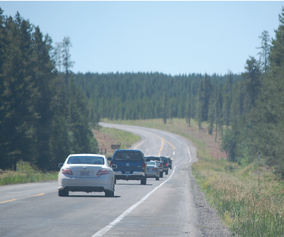
Passing and turning lanes already exist on a large portion of US-20 from Ashton, through Island Park to the junction of SH-87. Extensive research and data have shown that these will not be sufficient to provide an adequate level of service on the road and keep travelers safe once projected growth is realized. Investments of this scale must be thoroughly studied and all the work done that will ensure they last a long time. This study and the NEPA process through the future are looking toward a time when four lanes of travel on this section of US-20 will be essential. The work of the study and future efforts will make it so that once that time comes, the department will be ready to quickly move toward construction. They will only be implemented after further environmental analysis, and if or when predicted growth and traffic projections are closer to becoming reality.
An extensive amount of public meetings, workshops and more casual informative sessions have been held since the US-20 Ashton to SH-87 PEL process began. Based on input from the public early on, 59 alternatives were developed that have each been studied since then. During 2023-2024, ITD paused work on the more technical parts of the study to focus solely on public involvement. The department met with business owners, community interest groups, county and city leadership, with anyone who was affected by or showed interest in the project.
People voiced that they want to see projects done now that could improve safety immediately. As a result of that feedback, restriping on Ashton Hill was completed the summer of 2024 and the installation of a traffic signal at Yale-Kilgore Road is being installed in 2026.
ITD tried to better educate the public about environmental processes, when the improvements being considered would become reality, and all the factors that are involved in the study. At any given time, the department accepts and responds to public feedback on all ITD projects. In the name of safety, ITD will always look at data and growth projections to make sure we can keep Idahoans moving for a long time to come.
In the NEPA phase of this project, which is yet to begin, multi-use crossing opportunities at trails, pathways and bridges that intersect US-20 will be considered further. ITD will further study movement and wildlife migration with assistance and date provided from the Idaho Department of Fish and Game, the U.S. Forest Service and U.S. Fish and Wildlife Service. ITD is aware that this factor of planning for the future is of significant importance to those that have engaged in this project and will make sure options for wildlife crossing are considered as much as possible.
The study’s proposed improvements do vary by location, and the Idaho Transportation Department proposes expanding to four lanes with interchanges or wide medians throughout the corridor.
The alternatives that will be further evaluated in the NEPA process, which is anticipated will start in 2026 and beyond, are expected to change with further analysis and feedback from what is drawn on the map today. NEPA studies, preliminary design and final design will have to be done before construction can begin. None of what is seen throughout this PEL is happening next year, or for multiple years yet to come, and won’t be until it’s necessary. Clicking this link to the August 2024 online public meeting will give a general idea of what is being looked at in each of the different reaches of the US-20 Ashton to SH-87 PEL. These alternatives are the ones that have been selected to move forward after many suggestions and options from the public were studied as well.
Contact
Project Manager Gregg Bowman (208) 745-5321 or gregg.bowman@itd.idaho.gov
Resources
-
Summary document following an August 2024 Public Meeting
-
Summary of outcomes of August 2019 Public Meeting