It’s time to be “Idaho Ready” for winter driving

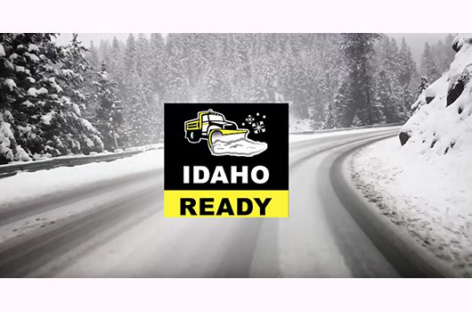
Ahead of the busy holiday travel season, the Idaho Transportation Department (ITD) encourages drivers to be “Idaho Ready” for winter driving. ITD’s annual winter safety campaign aims to help drivers prepare for challenging conditions on the state’s highways, before hitting the road.

“Idaho Ready” tips and resources will be shared weekly through ITD’s social media accounts and website itd.idaho.gov/travel. Short videos, blog posts, infographics, and photos will teach drivers how to safely get around this winter. Planned topics include navigating the new Idaho 511, general winter driving tips for Idaho newcomers, how to keep vehicles ready for colder temperatures, and snowplow ride along videos to hear safety advice straight from ITD operators.

Each winter ITD’s 550 hardworking snowplow operators travel a combined 3.4 million miles clearing roads across the state. “Idaho Ready” also focuses on keeping these important employees safe. When encountering a snowplow on the road, drivers are reminded, the safest place is behind the plow—never pass a snowplow on the right.

Other quick winter travel tips:

  • Check the road conditions before traveling. Visit 511.idaho.gov or download the Idaho 511 app for an easy look at weather reports, cameras, and more. Idaho 511 updates are now tweeted too! Follow @Idaho511 on Twitter.
  • Keep a winter emergency kit in your car with food/water, small shovel, warm blanket, etc.
  • When roads are wet or icy, slow down and give yourself more stopping distance. Turn off cruise control and remember, bridges and overpasses are the first to freeze when temperatures drop.
  • If you do slide, stay calm, brake very gently, and turn your wheel in the direction of the skid. Try not to overcorrect.
  • Keep your windshield completely clear of snow and ice. Fill up on windshield washer fluid, make sure your tires are in good shape, and battery is charged. Learn how to use tire chains and carry them with you.
  • Give our snowplow drivers room to work. Never pass a snowplow on the right! The safest place is behind the plow where the road is clear.
  • Let others know your travel plans, especially if you will be driving through areas with no cell service. Check in when you make it.
  • Beware of drowsy driving! Stop and rest when needed, and plan breaks on long road trips. Rest areas are mapped on Idaho 511.
  • If your holiday celebrations include alcohol, plan ahead for a sober ride home. Look out for your friends and family and help them get home safely too.
  • Buckle up, stay engaged behind the wheel, and drive for the conditions this winter.

Follow along with ITD and the Idaho Ready campaign this winter:

Closures tomorrow on Interstate 15 in Idaho Falls for sign installation

Map of I-15 project area in Idaho Falls

Sign installation will begin tomorrow on Interstate 15 in Idaho Falls. These signs will replace the previously removed directional signs that had been in place since the 60’s.

Various closures will be required while work is underway so crews can safely complete installation.

“At approximately 7:30 a.m. we will close the northbound I-15 on-ramp at Exit 118,” said ITD Project Manager Ken Hahn. “Once work is complete on that section, installation will progress to the next area and closures will occur in the two right lanes of the northbound off-ramp at Exit 119.”

In addition to the daytime closures, an overnight closure of eastbound Grandview Drive over I-15 will occur Wednesday to complete traffic signal work in the area. Motorists will be detoured to Saturn Avenue during this time.

“The detour for Grandview Drive is identical to intermittent traffic patterns used throughout the duration of this project,” stated Hahn.

Signage will be in place to direct motorists traveling through the region while this work is underway.

Installation of these signs, and the traffic signal work, are part of the final stages necessary to complete work on a larger ramp reconstruction project that began in May of this year.

Weather permitting, sign installation is expected to be complete by Thursday.

US-26 in Idaho officially named POW-MIA Memorial Highway during ceremony and sign unveiling in Carey

Image of US-26 POW-MIA Memorial Highway Sign Locations

Idaho legislators, representatives from the National League of POW-MIA Families, community members and the Idaho Transportation Department will officially celebrate the naming of US-26 in Idaho as the “POW-MIA Memorial Highway” at 2 p.m. Wednesday, October 6, 2021, at the Carey City Park – Boyd Stocking Pavilion.

During the 2021 Idaho legislative session, HB132aa sponsored by Representative Scott Syme and Senator Patti Anne Lodge, formally designated and named US-26 in Idaho, the POW-MIA Memorial Highway. The bill unanimously passed both chambers, respectively, and was signed by Governor Little in April.

Idaho is home to eight soldiers designated as MIA and the City of Carey happens to be home to one of those individuals. Jon Michael Sparks was a helicopter pilot for the US Army and was lost in Long Binh Province, Laos, on March 19, 1971.

US-26 in Idaho runs from the Oregon border to the Wyoming border. The highway naming is part of a nationwide effort to designate US-26 as the POW-MIA Memorial Highway from coast to coast, with several other states participating over the years as well.

There are 10 locations across US-26 in southern Idaho where new POW-MIA Memorial Highway signs will be installed.

Rock scaling to begin next week along US-93 in Eastern Idaho

Road Work Ahead sign

On Monday, Sept. 27, a specialized crew will begin scaling operations along US-93 between Salmon and Challis. This work occurs regularly throughout Eastern Idaho to remove loose rock along the canyon wall that has a potential to fall onto the highway and create a hazard for motorists.

“Beginning next week and continuing through October, a team of five specialists will rappel down selected slopes to assess the area and dislodge rocks that may pose a danger,” ITD Geologist Shawn Enright said.

Scaling will occur Monday through Friday between the hours of 7 a.m. to 5 p.m.

For the safety of motorists, the roadway will be closed to traffic for up to 20 minutes at a time while work is underway. Drivers are advised to watch for flaggers who will be present to direct traffic through the work zone.

If necessary, emergency vehicles will be allowed to travel through active scaling areas once crews determine it is safe to do so.

Work will start north of Salmon and progress toward Challis. The following six locations will be addressed with this project:

  • US-93 milepost 314.5 to 314.85
  • US-93 milepost 286.55 to 286.7
  • US-93 milepost 274.75 to 275.2
  • US-93 milepost 259.91 to 259.94
  • US-93 milepost 259.05 to 259.2
  • US-93 milepost 252.8 to 252.9

“Since we began this work in 2005 we have noticed a substantial reduction in rock fall along our highways,” Enright stated. “Reducing unplanned rock fall allows our maintenance crews to focus on other activities throughout the year and, more importantly, it provides for a safer roadway for motorists.”

ITD seeks feedback on draft Americans with Disabilities Act Transition Plan update

As the Idaho Transportation Department updates its Americans with Disabilities Act (ADA) Transition Plan, the public is encouraged to learn more about plans to invest nearly $35 million into projects and services over the next 15 years.

ADA Transition is the process of eliminating accessibility barriers to existing pedestrian infrastructure on the state highway system. It also helps identify programs that fund improvements through a coordinated effort with local highway districts and other municipalities.

In an effort to gather feedback about the plan, ITD will host an online survey as part of a 30-day public comment period that begins Sept. 17. The survey can be accessed at itd.idaho.gov/planning by clicking on the link. The survey is available 24 hours a day.

Staff will also hold a virtual public information meeting on Tuesday, Sept. 28 at 6:00 p.m. Mountain time. 
You can find the meeting link posted online at itd.idaho.gov/planning or by emailing ADA@itd.idaho.gov.

Comments and feedback shared during this public involvement phase will be incorporated into a draft ADA Transition Plan, that will become official after review and approval by the Federal Highway Administration and Idaho Transportation Board later this fall.

For questions or to learn more about ADA Transition, please email ADA@itd.idaho.gov or call (208)332-7823.

Public invited to share input on ways to improve US-26 & 25th East in Idaho Falls

Image of US-26 and 25th East in Idaho Falls

The Idaho Transportation Department (ITD) invites members of the public to attend a meeting for the US-26 & 25th East project in Idaho Falls. The meeting will be held in open house format on Thursday, Sept. 23. Individuals are welcome to stop by at any time from 5 p.m. to 7:30 p.m. at the Bonneville High School Commons Area – 3165 E Iona Rd. in Idaho Falls.

ITD has been analyzing needed improvements to the intersection of US-26 (Yellowstone Highway) and 25th East (Hitt Road) in Bonneville County. The goals are to enhance safety and mobility while accommodating current and projected traffic growth. In addition to this intersection, analysis included:

• 25th East (Hitt Road) and E Iona Road
• US-26 (Yellowstone Highway) and E Iona Road
• Potential impacts to traffic at other nearby intersections

The meeting will provide an opportunity for the public to view displays and give input on potential alternatives. Members of the project team will also be on hand to answer questions about the project.

For those who can’t make the meeting in person, meeting displays will be posted on the project website https://itdprojects.org/projects/us-26-25th-east on Friday, Sept. 24.

The comment period will remain open until October 8, 2021.

Construction projects underway in Bonneville, Madison and Fremont counties

Image of construction in District 6

The Idaho Transportation Department will continue and begin new work on multiple highway projects throughout the region from now until late fall. Six different projects will address portions of Idaho Highway 33, US-20 and US-26 to provide for a smoother and safer driving experience for motorists.

ID-33
• Roadway reconstruction from Newdale to Teton (milepost 100 – 107).

US-20
• Installation of center line rumble strips in Island Park (milepost 363.7 – 406.3).
• Roadway rehabilitation from Sheep Falls to Pinehaven in Island Park (milepost 395 – 377.5).
• Preservation work on 14 bridges in Madison and Fremont counties (milepost 331.9 – 398.76).

US-26
• Roadway rehabilitation from Swan Valley to the Wyoming State Line (milepost 376.8 – 403).
• Replacement of drain catch basins, asphalt and curb at the railroad underpass in Idaho Falls (milepost 333.5).

For construction along ID-33 and US-20, motorists will encounter lane reductions. Flaggers and pilot cars will be present to direct traffic through work zones in the Newdale and Island Park area. Night work on various bridges along US-20 will also take place between the hours of 8 p.m to 6 a.m.

Lane reductions are also in effect for the rehabilitation project on US-26, with pilot cars present to direct motorists.

While work occurs on US-26 at the railroad underpass, both northbound lanes will be closed between D Street and South Boulevard. A detour will be in place for non-commercial motorists and trucks will be advised to use an alternate route.

“These projects are an important part of preserving and extending the life of our roadways,” said ITD District Engineer Jason Minzghor. “We appreciate the patience of all motorists traveling through the area while construction is underway.”

When traveling through work zones, drivers are advised to pay attention to signage, slow down and watch for workers and heavy equipment in the area.

ITD looking for Public Information Officer for East Idaho

If you are interested in working for an award-winning, dynamic, professional state agency with a constructive culture focused on outstanding customer service and continuous employee improvement, we may have the job for you! This opening is an opportunity to use your media relations, writing and collaboration skills to promote the mission of the Idaho Transportation Department (ITD) as they fill an opening in the East Idaho region.

ITD is recruiting for a Public Information Officer to join the department’s Office of Communication in telling the story of one of the best transportation departments in the country. This position can be based out of our District 5 location in Pocatello OR our District 6 location in Rigby.  Candidates must have strong writing skills, experience interacting with news media, an understanding of how to use social media effectively and the ability to develop successful outreach campaigns, facilitate public meetings and assist with internal communication.
Regardless of which location is home base, this position will travel weekly between District 5 (Pocatello) and District 6 (Rigby).


Use either of these links to access the job application:

If you’ll be based in Rigby or eastern Idaho

If you’ll be based in Pocatello or southeastern Idaho

ITD to meet with freight stakeholders

A truck climbs a hill

The Idaho Transportation Department will meet with freight stakeholders across the state this September to collect feedback and update its freight plan.

The Idaho State Freight Plan identifies how ITD will strategically invest state and federal funding in infrastructure to increase the safety, capacity and efficiency of the freight system for the benefit of the Idaho economy.

The document analyzes the needs and issues in Idaho, details policies and strategies to overcome them, identifies critical freight corridors and lists projects to be funded. These projects are supported by approximately $10 million of federal funding each year.

Freight stakeholders utilize infrastructure on a daily basis for basic operations and produce, ship/receive or transport the majority of goods within the state. Such industries include: agriculture, forestry, fishing and hunting, mining, utilities, construction, manufacturing, wholesale trade, retail trade and transportation and warehousing. Those who would like to participate in the process should contact Scott Luekenga at (208) 334-8057 or scott.luekenga@itd.idaho.gov to get details on the available times and locations.

Participants will be guided through a 30-minute survey based on their industry. They are invited to engage in person at the following events:

  • Lewiston on Sept. 2
  • Blackfoot on Sept. 16
  • Twin Falls on Sept. 21

Virtual opportunities will also be accommodated through the end of September. Another round of public comment is expected in spring 2022 to review the updated plan.

New landslide database provides tool for project development and hazard mitigation

The Idaho Geological Survey (IGS) is helping the Idaho Transportation Department (ITD) learn more from landslides in the Gem State. A new statewide inventory database of landslide and rock fall hazards released by IGS in late June will assist ITD, emergency managers, and planners with forecasting and hazard mitigation by identifying problematic hot spots.

The project was sponsored by ITD’s Division of Highways – Construction and Materials team and funded through ITD’s Research Program.

The inventory contains more than 2,400 landslide entries spanning from prehistoric to active events. It’s posted on the IGS website and can be accessed through an interactive webmap service.

The information was also added to ITD’s IPLAN online ArcGIS platform. The database includes attributes to maintain MSE retaining wall locations and risk factors to evaluate the condition of the wall, as well as attributes for rock fall risk, so ITD districts can assess the problematic areas that could cause road closures.

Data were compiled from historic archives, information provided by ITD geotechnical staff and district geologists, unpublished IGS field observations, analysis of LiDAR imagery, remote sensing, satellite images, and newly mapped landslides.

“The study represents a live catalog of mass movements across the state with a particular focus on transportation corridors and urban areas,” said State Geologist and IGS Director Claudio Berti. “The database is a tool for documenting and assessing slope stability hazards. It is not intended to predict future events, but to document known events and show broad patterns of occurrence.”

This new database replaces the last inventory published in 1991, a static map no longer suitable for modern digital analyses. The 2021 version will be kept up to date as new events occur or new information becomes available.

Landslide problem areas in Idaho include: Bonners Ferry, Clearwater River Basin, Horseshoe Bend, Boise Foothills, Hagerman, U.S. 95 between Pollock and Lucile, and U.S. 26 between Swan Valley and the Wyoming border. Geologic characteristics of the bedrock, fractures, systems, precipitation, regional hydrogeology, vegetation, wildfires, and steepness of hillslopes are all contributing factors in landslide initiation and development.

You can also learn more by reading the full research report linked here.