Statement from DMV Administrator about recent outages affecting issuance of driver’s license services
Statement from DMV Administrator about recent outages affecting issuance of driver’s license services
Statement from ITD Division of Motor Vehicles Administrator Alberto Gonzalez about recent outages affecting the issuance of driver’s license services in Idaho.
“This level of service affecting citizens, sheriffs and the Idaho Transportation Department is unacceptable. ITD has been continuing to work with our vendor as they work toward a solution, but outages have increased and even spread to other states. We need an Idaho solution.
ITD’s solution is to eliminate the dependency on the real time communication with our vendor’s software. ITD plans to implement the solution statewide by Thursday. It would allow county staff to input customer information in person without having to communicate in real time with our vendor. It will be stored on a server. At the end of the day, information would be provided to the vendor.
We believe this will allow county and ITD staff to provide a level of service our citizens and partners deserve.
To our partners at the county sheriff offices: We appreciate and share your frustration and concerns and are committed to fixing these problems. We are ready to meet with sheriffs and partners on solutions that will help us move forward.”
Below is the letter ITD sent to Canyon County Sheriff Kieran Donahue in response to his correspondence with Governor C.L. “Butch” Otter.


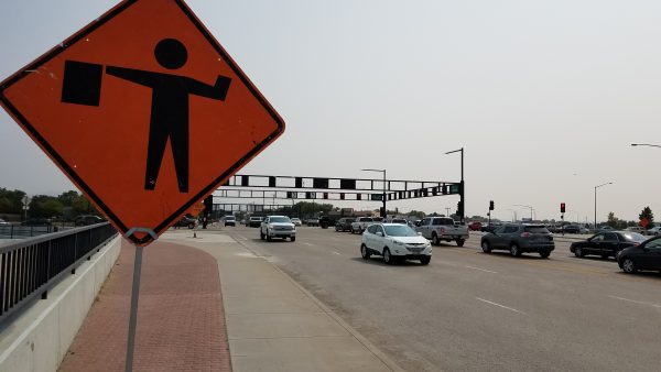 Overnight maintenance on the Cole Road and Overland Road intersection over Interstate 84 is scheduled to begin next week. Improvements will seal the road surface and preserve pavement life.

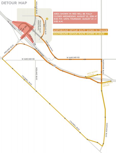 Wed., Aug. 22 at 8 p.m. to Thurs., Aug. 23 at 5 a.m.: The interchange will be closed while crews install new traffic signals at the Midland Boulevard/Karcher Bypass intersection and remove two overhead signs. Midland Boulevard, Karcher Bypass, Exit 33 A, 33B and the westbound entrance ramp will all be closed to traffic. Motorists will be detoured via Nampa/Caldwell Boulevard and the Karcher Connector.