Work on the I-90 bridges near Cataldo will begin to impact traffic

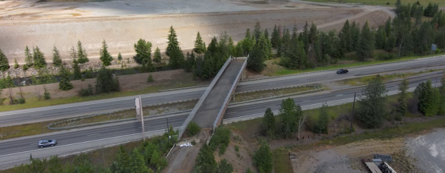
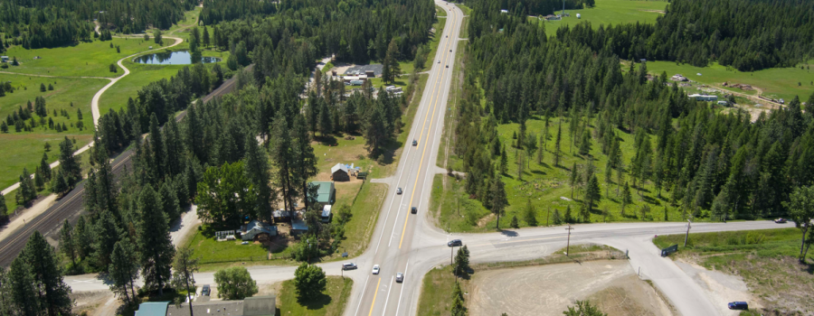
Aerial view of the I-90 bridges over the Coeur d'Alene river near Cataldo

Starting next week drivers will be required to slow down and merge into a single lane in both directions as work resumes to reconstruct the Interstate 90 bridges over the Coeur d’Alene River near Cataldo. These bridges were first built in 1964 and are ready for replacement.

As early as mid-March all traffic will be shifted on to the westbound side of the interstate to allow crews to demolish and reconstruct the eastbound bridge. Next year, the westbound bridge is scheduled for replacement with traffic shifted to the new eastbound bridge. Work will end in late 2026.

River and trail users will also experience impacts during the 2025 construction season.

River Impacts

Beginning April 1 recreational access and use of the river, including boating, kayaking, tubing, swimming and fishing will be restricted for 500 feet on both sides of the bridges Monday through Saturday from 6 a.m. to 6 p.m. Boat launches outside of the work zone will remain available for use, though no one will be able to pass underneath the structure during working hours for safety reasons.

Construction will take scheduled breaks during the major summer holidays and access to the river will be available for recreation.

Signs will be posted locally at boat launches and access points that will update users of restrictions or changes throughout the construction process.

Trail of the Coeur d’Alenes Impacts

During construction trail users should be aware that there may be intermittent closures of five or ten minutes as equipment and materials are transported across the trail during day to day operations. Flaggers will be present during these closures to ensure safe crossing for crew members, vehicles and trail users.

Trail users should exercise caution in areas adjacent to the work zone for the possibility of loose dirt or gravel on the trail surface.

In 2024 a temporary work bridge was constructed across the river to provide crews and equipment access. Crossover lanes were also constructed on both ends of the work zone to allow for vehicles to be shifted during construction to maintain the flow of traffic.

Map depicting the I-90 work zones from Post Falls to Cataldo for the 2025 construction season.


This project is one of several that will dot the I-90 corridor from the Washington state line to the Silver Valley in 2025, including expanding the freeway to four lanes between Post Falls and Coeur d’Alene, upgrading the I-90 State Highway 41 Interchange, and repaving from Wolf Lodge to Fourth of July Pass.

Drivers are encouraged to use the Idaho 511 system, either online, by phone or through the app, for updates on conditions and traffic impacts throughout the construction season.

Significant traffic changes ahead for construction on the I-90, SH-41 Interchange in Post Falls

Aerial view of the westbound I-90 SH-41 exit loop ramp

Starting Monday, March 3, the Idaho Transportation Department will be making several significant changes to traffic near the Interstate 90 and State Highway 41 Interchange. These changes are necessary to accommodate ongoing construction efforts as ITD nears a major milestone of the project with the completion of the new Single Point Urban Interchange.

I-90 westbound off ramp to get to SH-41

  • Closed March 3 through Fall 2025
  • Traffic will be detoured to the Seltice Way Interchange at Exit 6. Click here for detour map.
  • A temporary signal has been installed at Seltice Way to handle detoured traffic exiting the interstate

On ramp from SH-41 to get onto eastbound I-90

  • Closed overnight from 8 p.m. to 5 a.m. from March 3 through mid-March
  • Traffic will be detoured west on Seltice Way to the exit 6 eastbound on-ramp.

SH-41 under I-90                                                                                       

  • Closed March through mid-April
  • Traffic will be diverted to Greensferry Road while crews deconstruct the temporary bridge and work on utilities. Click here for detour map.

Central Avenue                                                                                          

  • Closed early March through Fall 2025
  • Click here for a map of available business accesses.

Overnight single lane closures on I-90 in both eastbound and westbound lanes throughout the work zone

  • 8 p.m. to 5 p.m. March 3 through mid-April

Westbound on ramp for SH-41 traffic


Additional changes to the westbound on-ramp are coming later this spring. Details will be shared as soon as they are available.

“Reconstructing the westbound off-ramp and improving SH-41 is a key part of the project’s success,” said project manager Randy Durland. “We thank the public again for their patience during these closures as crews continue to make significant progress towards the finish line.”

Construction on the new ramp and SPUI is expected to be complete in 2026.

Drivers can use the Idaho 511 system for updated traffic conditions, detours and delays by dialing 511, visiting the website, or downloading the app to your smart device.

To learn more, visit the project website at https://itdprojects.idaho.gov/pages/i90sh41ic, call 208-738-4190, or email info@i90corridor.com.

Open house Thursday, March 6, to share preliminary design plans to improve US-91

Drone photo of Siphon Road north of Chubbuck

The Idaho Transportation Department is hosting an open house on Thursday, March 6, to share information and gather community input about plans to improve U.S. Highway 91 between Siphon Road and Reservation Road to address increased growth.

The public is invited to view preliminary design plans in person from 4:30 to 6:30 p.m. at Tyhee Elementary School at 12743 W. Tyhee Road in Chubbuck. Community members are encouraged to stop by to learn about the project and provide feedback. Project staff will be available to answer questions.

Preliminary design plans currently include:

  • Widening US-91 between Siphon Road and Tyhee Road to two lanes in each direction with a center turn lane between Siphon Road and Tyhee Road.
  • Resurfacing US-91 between Tyhee Road and Reservation Road.
  • Improving residential access in the project area.

Those who are unable to attend in person are invited to view identical project information online and comment from March 6 to March 20 at itdprojects.idaho.gov/pages/us91-siphontoreservation.

“ITD recognizes how vital US-91 is to the Chubbuck area, and we want to be prepared as growth in the area continues,” Project Manager Bo Frasure said. “Input from the community will be essential as we move forward on this project.”

More information about the US-91 Siphon Road to Reservation Road project is available at itdprojects.idaho.gov/pages/us91-siphontoreservation.

I-15 Inkom corridor construction and detour begins Monday

The Idaho Transportation Department and its construction partner Wadsworth Brothers Construction is beginning reconstruction of Interstate 15 at Inkom.

Work will replace I-15 bridges in three locations:

  • Over the Union Pacific Railroad (UPRR) tracks and Old Highway 91.
  • Over Rapid Creek Road (Main Street).
  • I-15 bridges and reconstructing the West Interchange.

ITD combined and streamlined the projects to reduce the construction timeline to approximately two years rather than doing one location at a time over three years. This approach minimizes disruption to the local community and the traveling public and efficiently uses construction funds.

Old Highway 91 will be closed under I-15 beginning Monday, weather and other factors permitting, to allow Idaho Power to relocate utilities. Local access will be allowed. Other drivers will be detoured along Rapid Creek Road (Main Street). The detour will remain in place until mid-June.

I-15 traffic will be reduced to one lane in each direction from early March until late October.

For project progress and to sign up for construction updates, go to the project webpage at itdprojects.idaho.gov/pages/i15-inkom-corridor. Motorists are encouraged to use 511.idaho.gov or the 511 app to keep track of project detours.


Right turn only restrictions at I-15 Stoddard Creek exit

Road Closed signs in place on Stoddard Creek Road underneat I-15 Stoddard Creek Exit 184.

The Idaho Transportation Department is continuing repairs to the Stoddard Creek Bridge at Exit 184 on Interstate 15. Stoddard Creek Road underneath the I-15 bridge is closed for safety, as crews work to demolish the current bridge deck above.

Both northbound and southbound travelers exiting the freeway will only be able to make right turns from the ramps on to Stoddard Creek Road. Drivers cannot turn left and travel underneath the closed bridge. This restriction will remain in effect until work is completed, which is estimated to be late spring.

The recreational parking area west of the Stoddard Creek Exit is only directly available for southbound I-15 drivers. Northbound traffic needing to access the recreational parking area should proceed six miles to Humprey Exit 190, then head back southbound to exit at Stoddard Creek. From this direction, a right turn to the parking area can be safely completed.

Updates on this closure and construction can be found on the Idaho 511 app and at 511.idaho.gov.

ITD to temporarily close section of US-20 tomorrow for snow removal

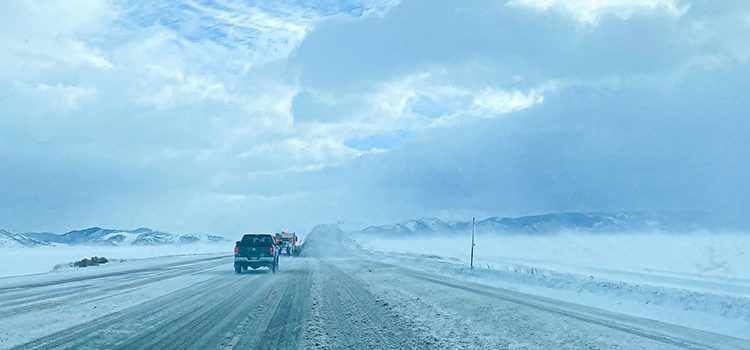
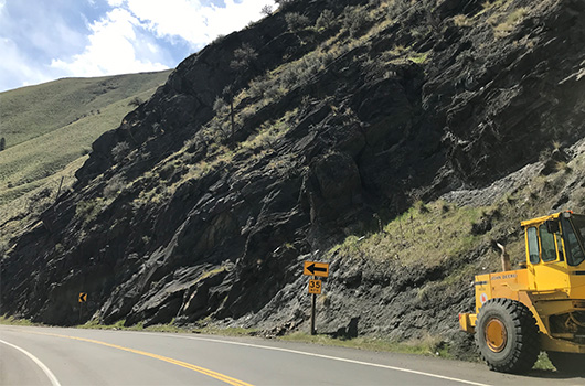
In preparation of more snow in the region, we will temporarily close U.S. Highway 20 from Anderson Dam Road to Hill City tomorrow.

In preparation of more snow in the region, the Idaho Transportation Department will temporarily close U.S. Highway 20 from Anderson Dam Road to Hill City tomorrow (Feb. 12, 2025).

ITD crews will work to remove built-up snow and overhangs along the highway to improve safety and allow for more effective plowing. To protect workers and motorists, this stretch of US-20 will be closed from 11 a.m. to 5 p.m. during the snow removal effort.

“We understand this is an important route for many travelers, and our goal is to keep it as safe as possible. Clearing this snow now will make the highway safer for everyone, especially with more snowfall expected as early as Thursday,” Foreman Gabe Sielaff said.

Drivers should plan alternate routes and check 511.idaho.gov for the latest road conditions before traveling.

Second community open house about the Dry Creek Bridge on US-30 to be held in Murtaugh

A truck crosses an old bridge near Murtaugh

The Idaho Transportation Department is hosting a community open house on Tuesday, Feb. 18, to share updated design plans for the replacement of the Dry Creek Bridge located on U.S. Highway 30.

The open house will run from 4:30 to 6:30 p.m. in the Murtaugh High School Cafeteria (500 Boyd St. W. Murtaugh, ID 83344). An online option will be available at ITDProjects.idaho.gov/pages/US30DryCreek from Feb. 18 to Feb. 24 to give members of the public who cannot attend in person a chance to participate.

“The project team has been working hard since October to design the new bridge,” said ITD project manager Brent Brumfield. “We’ve designed a new bridge that will last a very long time and takes into account the feedback we got last year.”

Originally built in 1934, the existing bridge is a two lane, 60-foot long and 26-foot wide concrete arch structure that crosses Dry Creek just north of Murtaugh Lake. It is one of several open-spandrel arch bridges in Idaho and was state of the art for its time.

The new bridge will be a 111-foot pre-stressed concrete girder bridge. ITD will also repave the highway where it ties into the bridge, provide updated guardrails and build the bridge at a higher elevation to improve sight distance for motorists.

For more information, or to participate in the online open house, visit ITDProjects.idaho.gov/pages/US30DryCreek.

Drivers urged to use US-95 Aht’Wy Interchange for safety

The Nez Perce Tribal Police, with the support of the Idaho State Police (ISP) and the Idaho Transportation Department (ITD), are urging drivers to follow posted signage and use the Aht’Wy Interchange on U.S. Highway 95 near the Clearwater River Casino and Lodge. Motorists who disregard road closures and traffic signs create dangerous situations that could lead to serious crashes and fatalities.

Since the interchange was opened at the eastern entrance and access at the western entrance was modified, all agencies have observed unsafe behavior. Eastbound drivers on US-95 have been seen illegally crossing the unpaved median to turn left into the access near the Nez Perce Express gas station, rather than traveling a half mile further to use the interchange. Some have even waited in oncoming traffic to make the prohibited turn, risking head-on crashes.

In response, ITD has increased signage and added barriers to further deter travelers from making this movement while soliciting the support of law enforcement.

“Drivers must pay attention to posted signage and recognize that this is a change,” said Nez Perce Tribal Chief of Police Mark Bensen. “While adjustments take time, using the interchange correctly is essential for everyone’s safety. This solution is designed to be safer for all drivers and reduce the risk of serious crashes.”

The western access to Aht’Wy Plaza near the gas station is one way and does not allow left turns of any kind. Drivers looking to turn left into the plaza or to exit the gas station should use the interchange.

Proper Use of the Aht’Wy Interchange

Rendering for how to use the interchange.

Entering

  • Take the Nez Perce Drive exit off the highway.
  • Slow down and stop at the intersection.
  • Turn onto Nez Perce Drive to access Aht’Wy Plaza.

Exiting

  • Follow signs on Nez Perce Drive back toward the interchange.
  • Use the appropriate exit ramp for Lewiston or Orofino.
  • Accelerate down the ramp to highway level and safely merge with US-95 traffic.

ISP troopers continue to monitor compliance and emphasize that changes in driver behavior are necessary to prevent further incidents.

“Too many motorists are ignoring traffic control measures and creating serious risks to other drivers,” said ISP Lieutenant Ken Yount. “We will continue having a presence in the area to ensure compliance and improve safety.”

The interchange is part of a significant engineering initiative to enhance traffic safety and reduce collisions in an area historically prone to fatal accidents.

“This interchange was carefully designed and implemented to improve traffic flow and minimize conflict points, ultimately reducing the potential for severe crashes,” said ITD District 2 Engineer Doral Hoff. “These changes prioritize safety and efficiency for all drivers, and we strongly encourage motorists to use the interchange as intended to prevent further tragedies.”

A downloadable map is available to help drivers better understand the interchange and ensure safe travel.

For more information, please contact the Nez Perce Tribal Police, ISP, or ITD.

‘The Salt Seeing Eye:’ the snowplow driver’s crystal ball

A hand points out the screens inside the cab of a snowplow, one of which shows the truck bed holding salt.

If we each had a crystal ball, just think of all the time, money, pain or heartache we could save!

While not exactly a crystal ball, Idaho Transportation Department plow operator Skylerr Valentine, with help from the Idaho Falls shed crew, has come up with an innovation that’s a little bit close. Well, for ITD operations folks in terms of work that is.

Valentine pondered on the fact that while plowing, he would need to make multiple stops through his route to climb up the truck bed and see how much salt was left. This of course involved pulling over, getting out of the cab and physically climbing on the heavy equipment. On newer dump/ plow trucks, a small ladder is fitted to the side of the bed. On older ones that still operate in force across the state, this salt check involves navigating from the stairs of the cab across to one of the rims of the truck bed. Valentine actually once fell while doing just that.

He figured that surely a camera could be installed to show down into the sander box that holds augers and salt. This would allow salt levels to be monitored visually just like wing plows are. He happened to be aware of a truck in east Idaho that was on the surplus sale line and talked to ITD Fleet Manager Dalton Rice about using the outdated wing plow camera from it to test out this innovative idea.

With the help of the entire Idaho Falls crew and ITD electricians Josh Harris and Justin Romrell, that older camera was mounted to the truck bed and wired around, then into the cab, with concern for easy disconnect points to retain dump truck functionality. The smaller screen of the unit was mounted inside, just underneath the tablet typically used by plow operators. Valentine dubbed it the “Salt Seeing Eye.”

“It was a lot of work, figuring it all out just right,” he said. “We really tried to make sure it was waterproof and could stand up to the elements. I wanted to see it put to the test this winter.”

Tablets equipped inside plow trucks show drivers video of where their wing is at, and relay salt and brine output numbers right on the screen. They don’t, however, indicate when salt in the truck bed is gone. Those numbers keep on ticking, and the operator keeps on driving, thinking he’s covering the road when in fact, he’s sure not.

Multiple times Valentine, and surely other operators anywhere, would stop to check salt levels in the bed, only to see that it’s empty and have no idea how long it had been. Then begins backtracking to determine where to pick back up with salt application, essentially doing the same thing over again and wasting time.

“I would make a 70-mile round trip, having run out but no idea where,” Valentine said. “I had no idea how long ago it had been or how many miles really had nothing on the road.”

There are formulas and historical knowledge that can help operators determine just how far so much salt will cover.  Let it be said that ITD operations folks could certainly be given science and math degrees for the calculations they’ve mastered when it comes to doing the work they do. They rely on the output readings on the tablet in each truck also. Where those reading don’t stop even if the salt is empty, calibrations aren’t without a significant margin of error though.

“This could really help us find discrepancies in our calibrations,” Idaho Falls Operations Foreman Jared Loosli said. “It has the potential to save a lot of money when it comes to salt ordering.”

This winter, Valentine has indeed had the chance to put the new tool to the test. While plowing the five-lane section of US-20 west of Idaho Falls, he’s determined from the safety of the cab that he can in fact make one more pass on his route, where he normally would have stopped to check or headed back to the shed to refill.

The “Salt Seeing Eye” may not be the crystal ball that can help any one of us avoid bad personal life decisions, unfortunately. But with substantial time saved while snowplows are out doing the vital work they do, increased safety for operators that would no longer have to climb on heavy equipment in slick winter conditions, and visible cost savings through more accurate salt use calculations, this innovation certainly has the potential to greatly benefit operations across Idaho.

Ideally, this camera could come standard on all new ITD trucks and be paired with the typical tablet, becoming one of the options right on the screen operators use now.

Pleasant View Road scheduled to close south of SH-53

Looking at SH-53 south with a view of some of the new bridge structures being built.

The Idaho Transportation Department will close Pleasant View Road between State Highway 53 and Prairie Avenue as early as the first week of March. Drivers will be able to use either Prairie Avenue or McGuire Road to access SH-53. This closure is part of the SH-53, Pleasant View Road Interchange construction that started last fall. The project will enhance safety along the highly traveled SH-53 corridor by ultimately eliminating three railroad/vehicle crossings, streamlining access to SH-53, and increasing capacity on SH-53 and Pleasant View Road.

IMMEDIATE IMPACTS

In preparation for the Pleasant View Road closure, barricades will be installed the week of February 17 at the Prairie Avenue and Beck Road intersection to prevent left-turn movements to and from both streets.

  • Northbound drivers on Beck Road will need to turn right on Prairie Avenue and do a full rotation of the roundabout to access SH-53 from westbound Prairie Avenue.
  • Westbound drivers on Prairie Avenue will need to find an alternative route altogether to access southbound Beck Road.
Graphic showing a road closure on Pleasant View from Prairie Avenue to SH-53

Additionally, ITD is working closely with BNSF Railway to install a temporary signal on SH-53 at Prairie Avenue, which is anticipated to be active sometime in early summer. These restrictions will be in place until the Pleasant View Road Interchange is completed in summer of 2026.

“ITD understands that construction of this new interchange and associated improvements will significantly impact travel patterns for local and regional drivers,” said Project Manager James Dorman. “Safety is a top priority, and the measures taken during construction are done so with this objective in mind. We appreciate everyone’s patience and understanding as we work to increase safety and mobility for people using this corridor.”

The first features to be constructed include the footings for the Pleasant View bridge over the railroad tracks and the new alignment of SH-53 between Hauser Lake and Hollister Hills Roads north of the existing highway. One lane of traffic in each direction will predominantly be maintained on SH-53, and work will typically take place weekdays during daylight hours.

Construction of this project is being made possible now by a U.S. Department of Transportation Federal Railroad Administration grant that was awarded to ITD in mid-2023. The grant program was created to improve safety at rail crossings in communities across the country to save lives, time, and resources for American families. Additional financial contributions were made by ITD’s partnering organizations: BNSF Railway and the Post Falls Highway District. The estimated construction cost of this project is $30 million.

People are encouraged to stay informed by visiting the project website and subscribing to emails at itdprojects.idaho.gov/pages/sh53corridor. For statewide traffic information, and up to the minute information regarding impacts or delays along the SH-53 corridor, visit 511.idaho.gov, dial 511 by phone, or download the app.