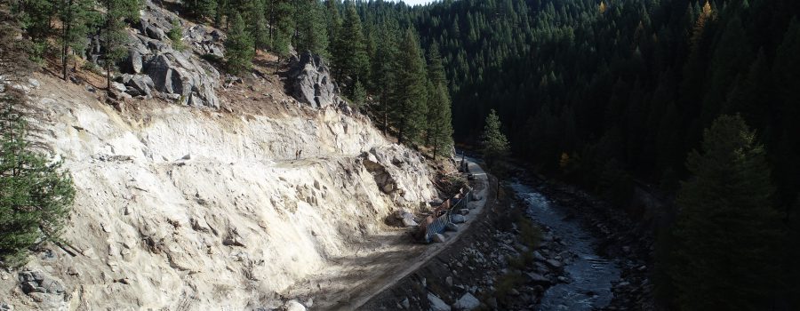
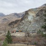
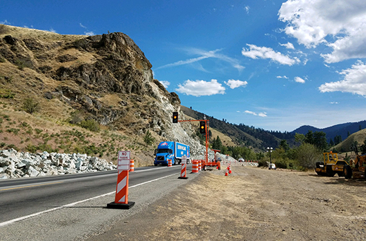
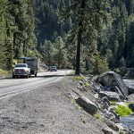
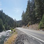
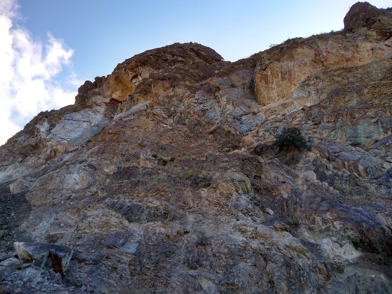
Both lanes of Idaho Highway 55 are now back open to traffic, as the Idaho Transportation Department’s Smiths Ferry project pauses for the winter.
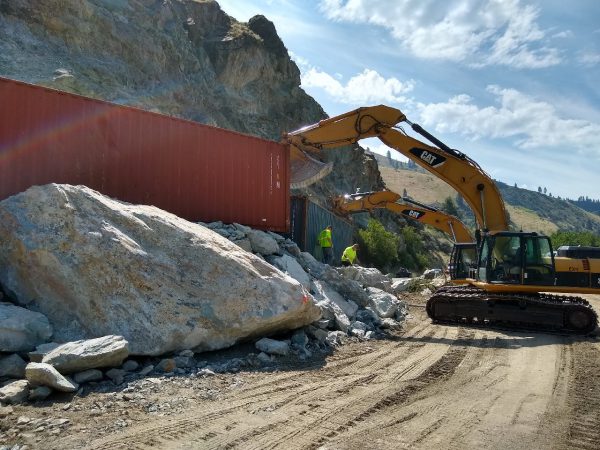
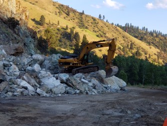
This fall crews made steady progress, working to widen shoulders, add guard rail, and straighten ID-55 between Smiths Ferry and the Rainbow Bridge. The project team safely removed 39,500 cubic yards of rock from the canyon through 17 controlled blasts.
Work will resume in mid-March 2021, weather permitting. For more information on the project and to sign up for updates, visit itdprojects.org/ID55smithsferry.
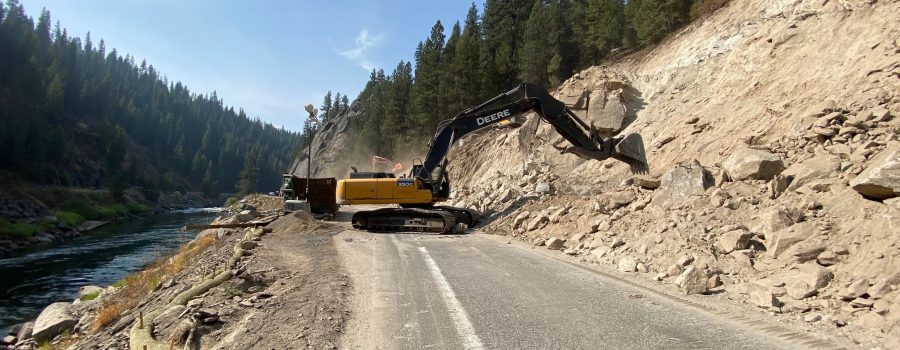
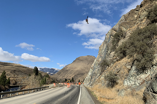
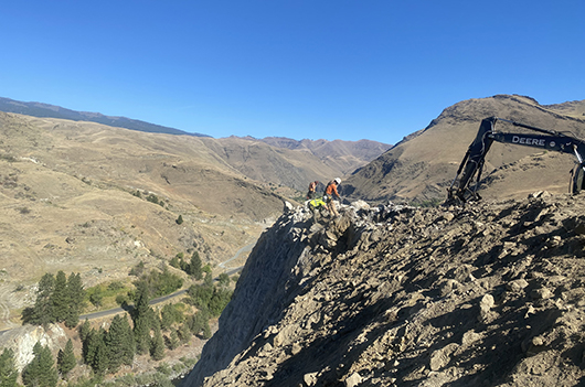
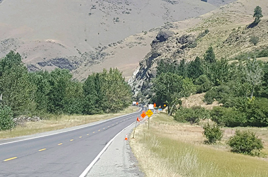
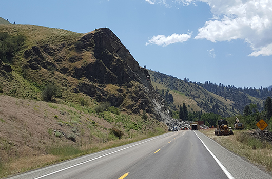
Rock blasting is underway between Smiths Ferry and the Rainbow Bridge as road construction continues on ID-55.
The goal is to make this narrow, curvy mile-long stretch of state highway safer, by building wider shoulders, adding guardrail, and straightening the road.
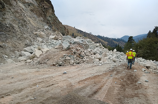
140,000 cubic yards of rock need to come off the canyon, and it’s happening one controlled blast at a time. How do they do it? It takes a lot of work and careful planning.
Strategically spaced holes are drilled into the rock differing in size and depth depending on the situation, then the explosives are placed inside.
“We’re using a nitro glycerin based dynamite as a primer, and then we use ammonium nitrate as a blasting agent,” said Blast Operator Ryan Miller. “Each hole is timed, a 40th of a second. We shot that in a V, and the reason it stayed on the hill is because we shot the center first, and kind of sucked it uphill.”
Each blasting design plan is closely reviewed.
“The whole idea is to move the rock in the direction we want it to. We don’t want to launch into the river, fly rock is our enemy,” Miller added.
Through late November, weather permitting, the work zone is closed to traffic every Monday through Thursday from 10 a.m. to 2 p.m. so crews can safely blast and haul away the rock.
Drivers are urged to plan around the closures or use US-95 as a detour.
“We don’t want people or cars traveling through the work zone during blasting. It’s also an incredibly tight work zone with the river off to the east and the rock faces out to the west. So giving the contractor that four hours is really letting them be as efficient as possible,” said Project Engineer Alex Deduck.
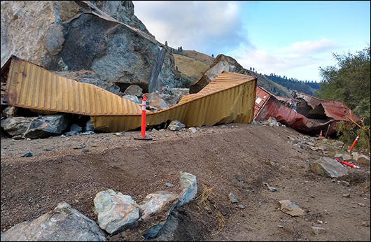
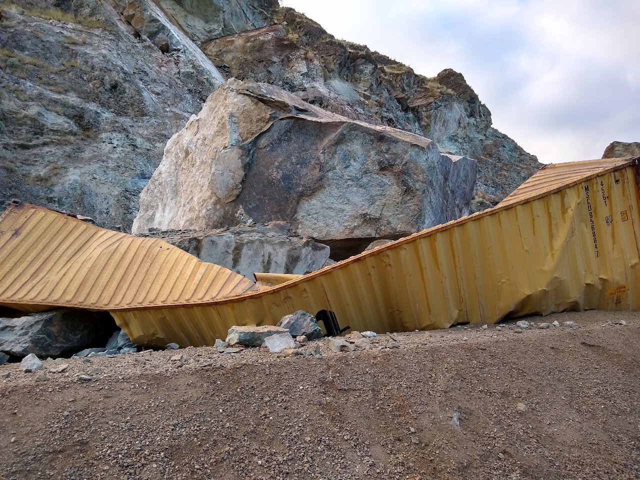
Steel containers and temporary barrier keep the falling rock from getting in the travel lane, and protect the crews working in this steep canyon. When the road is not fully closed, one lane is open to alternating traffic.
“Now that we’ve reduced it to one lane it’s even tighter, and just a hard area to work in,” Deduck said.
This winter, construction will pause and both lanes will be open.
In the spring, blasting picks back up with full road closures Monday through Thursday from 10 a.m. to 2 p.m., and during the busy summer, one lane will be open to alternating traffic Monday through Friday morning. Both lanes will be open Friday afternoon through Sunday.
You can learn more about the project and sign up for updates at itdprojects.org/ID55smithsferry. The project is expected to finish in late fall 2022.
For the latest road conditions, be sure to download the Idaho 511 app or visit 511.idaho.gov.
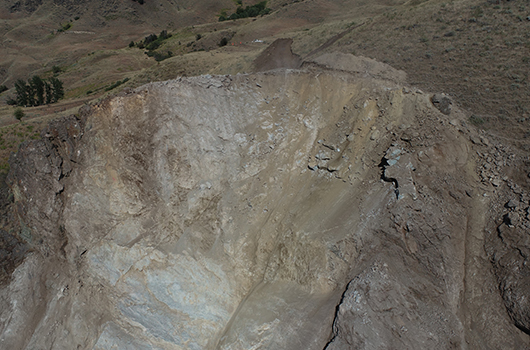
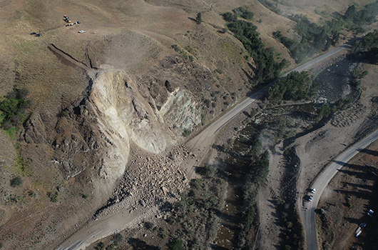
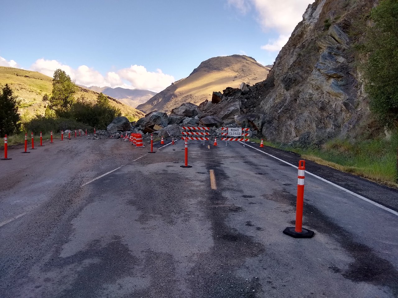
Long-term repairs to the US-95 slide south of Riggins are complete. The failing slope above milepost 188 has disrupted traffic on the state’s primary north-south route since it first fell July 3 and then again on July 10.
“With the changes we’ve made, we have greatly reduced the likelihood of another slide blocking US-95 again in the area,” Materials Engineer Janet Zarate said.
The unstable rock mass above the highway has been reduced through multiple rounds of blasting and scaling, and the remaining slope has been reinforced with cable netting bolted into the rock.
Last week crews reconstructed US-95 and repaved Old Pollock Road. The temporary signals that have been used to direct traffic since August 5 were also removed.
“Drivers may notice that the highway had to be shifted to provide room for a larger ditch,” Zarate said.
Within the coming weeks, crews will finish installing guardrail and add fencing on top of it to keep any future loose rock confined to the ditch.
“It’s been a hard push to get to this point, with more than twenty-five other companies involved,” Zarate said. “We appreciate the support given to us by residents and local officials over these last few months.”
november 13
A helicopter helps install cable netting on the US-95 slide south of Riggins
Crews were able to secure cable netting over the slope this last week with the help of a helicopter. Netting will help direct any rock that comes lose down the slope away from the highway and into the ditch.
At least two days of warmer weather are needed to finish paving US-95 and Old Pollock Road. Given variable weather conditions expected over the next week, crews will work when they can. Pay attention to road signs in the area for the latest schedule. During paving, drivers can expect up to 15-minute delays.
Repairs are on track to be completed by Thanksgiving.
november 3
Old Pollock Road before final repairs as part of the US-95 MP 188 mitigation project.
A three-day closure is expected this week on Old Pollock Road as crews enter the final phases of long-term repairs to US-95 south of Riggins after a landslide first closed the highway July 3.
Old Pollock Road served as a detour during the initial response to the slide.
“The county road had been closed since 2016 due to its own landslide, so in order to turn it into a viable detour, we had to widen it and improve the driving surface by adding gravel,” Materials Engineer Janet Zarate said. “Now that repairs to the US-95 slide are nearly over and we no longer need an alternate route, we need to take some of the weight off the slide area on Old Pollock Road by removing most of what we added, as well as address distressed pavement.”
The closure is planned Wednesday morning through Friday night. Drivers should pay attention to digital signs in the area for the exact times, as the schedule could vary.
“Once we’re done, there will be sections of new pavement, but drivers should expect a gravel surface and dip in the road across the old landslide area,” Zarate said.
Work also continues on the US-95 slide, with cable netting expected to be laid over the face of the slope the second week of November. A helicopter will be used to hold the netting above the slope as crews attach it to bolts that have already been embedded in the slope.
Helicopter activity is expected for at least two days, during which drivers should plan for 20-minute delays.
Once the netting is secured, crews will finish installing fencing at the base of the slide and repave the highway. Repairs are expected to be complete by Thanksgiving.
october 27
Drilling on the face of the slope is now complete. Next crews will start installing mesh at the top of the slope and removing the rock berm on the south side. Impacts to traffic – delays up to 15 minutes – are expected to remain the same until early November.
Remaining work includes installing cable netting on the face of the slope, installing fencing at the bottom of the slope, repairing the surface of US-95 and making minor changes to Old Pollock Road. Work is expected to wrap up in mid-November.
september 23
View footage from the final major blast in long-term repairs.
september 22
Both US-95 and Old Pollock Road are expected to close today at 11 a.m. PT / 12 p.m. MT to allow crews to blast 1,000 cubic yards of unstable rock from the slope adjacent to the active slide at milepost 188 south of Riggins.
The complete closure is expected to last about 30 minutes. After the blast, traffic will be allowed to travel through the area on the US-95 temporary road around the base of the slide or Old Pollock Road.
“Although this particular slope is not currently sliding, it has the potential to,” Materials Engineer Janet Zarate said. “We plan to proactively address it now while we have the right equipment and people in the area.”
This is the second major and final blast to remove material from the slope and will be much smaller than the first.
After blasting is complete, drivers can anticipate continued 20-minute delays for several weeks while geotechnical experts finish dislodging loose material.
“During those short-duration closures, the temporary signals will turn red,” Zarate said. “It’s important to stop so you’re not driving below boulders as they are being pushed off the rock face.”
Next steps for slope stabilization include reinforcing the remaining slope with bolts and wire fencing. Repairs are expected to take until mid-November to complete.
september 10
Photo of the slope above MP 188 on US-95 after blast
A small blast is planned for 15 minutes between 3 – 4 p.m. PT / 4 p.m. – 5 p.m. MT to remove additional leftover rock from the first blast. Both Old Pollock Road and the detour around the base of the slide will be closed.
Drivers should expect continued follow-up blasts as geotechnical experts scale and reassess the slope.
september 8
Photo of scalers on the US-95 slope south of Riggins
A blast at 3 p.m. PT / 4 p.m. MT today at the slide near Riggins will close Old Pollock Road and the detour around the base for 15 minutes. Check 511 for updates. These rocks made it past the first blast and days of scaling (see video), but we’ll get it taken care of today.
SEPTEMBER 2
The rubble pile after another major blast
Traffic at the US-95 slide south of Riggins is planned to shift from the detour on Old Pollock Road to the temporary road around the base of the slide tonight, thanks to quick progress on cleanup efforts since the blast last week. The route could reopen as early as 5 p.m. PT / 6 p.m. MT, but drivers should check 511.idaho.gov for updates as the deadline approaches.
“We’re able to open this up much sooner than anticipated,” said Janet Zarate, co-manager of the repairs and materials engineer for the Idaho Transportation Department. “Both our contractors and our own employees have worked long hours over the last several days, putting us ahead of schedule.”
In addition to clearing the roadway, crews finished rebuilding protective berms to shield traffic from any additional rock fall.
Traffic conditions will be similar as before the blast, but drivers should plan for additional 30-minute delays as scalers on the slope dislodge loose material. Scaling will continue throughout the week but minimal traffic impacts are anticipated over the holiday weekend.
“In just a few short months, we will have built something that will protect drivers below for decades,” Zarate said. “The inconvenience of delays in the coming days will help keep travelers safe and prevent long-term delays in the future.”
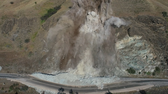
Last Friday, both US-95 and Old Pollock Road were closed for half an hour while crews detonated 6,000 pounds of explosives, removing 14,000 cubic yards of unstable material from the slope.
A second blast in the coming weeks will address stability concerns for the adjacent slope to the south.
Still of the blast on US-95 MP 188 south of Riggins
Blasting to remove unstable material from the US-95 slide south of Riggins earlier this evening was successful. An estimated 14,000 cubic yards of unstable rock from the slope at milepost 188 were removed, which is the same amount of rock that has already fallen to the road since the first slide on July 3.
Traffic can now run on Old Pollock Road. Cleanup efforts on the detour around the base of the slide are expected to take up to one week, after which traffic will be shifted back on to US-95.
The one-hour closure is now expected to start at 4:30 p.m. PT / 5:30 p.m. MT at the earliest. For the most up-to-date information, check 511 as conditions may change.
AUGUST 28 morning update
Both US-95 and Old Pollock Road are expected to close tonight from 3 to 4 p.m. PT / 4 to 5 p.m. MT to allow crews to blast an estimated 14,000 cubic yards of unstable rock from the slope at milepost 188. Just as much rock has already fallen to the road since the first slide on July 3.
After the blast, traffic will remain on Old Pollock Road until the slope is determined to be stable and crews can clear the detour around the base of the slide. Cleanup efforts are expected to take up to one week.
This is the first of two blasts planned to correct the slope failure. The second blast has not yet been scheduled.
After blasting, long-term repairs will include reinforcing the remaining slope with bolts and wire fencing.
August 25 update
Photo of drilling equipment preparing the slope above milepost 188 on US-95 for blasting
Both US-95 and Old Pollock Road are expected to close Friday evening (Aug. 28) to allow crews to blast an estimated 14,000 cubic yards of unstable rock from the slope, the same amount that has fallen to the road since the first slide at milepost 188 on July 3.
Traffic will be shifted onto Old Pollock Road Thursday night in anticipation of the blast. The complete closure on Friday is expected to last just one hour, and after the blast, traffic will be allowed to travel through the area on Old Pollock Road.
“Our priority is to ensure that the residual rock is stable after the blast and to clear the temporary road around the base of the slide,” Operations Engineer Jared Hopkins said. “That could take up to a week, during which we will need to keep traffic on Old Pollock Road.”
This blast is the first of two planned to remove material from the slope. An update will be sent later this week with the timing of the blast on Friday evening. The second blast has not yet been scheduled.
Long-term repairs also include reinforcing the remaining slope with bolts and wire fencing. They are expected to take until late October to complete.
A semi passes the temporary signal at the US-95 slide south of Riggins
Drilling will begin today at the US-95 slide south of Riggins. This is part of the long-term repairs, which will involve controlled blasting and reinforcing the rock face, that are planned for completion in late October. The unstable slope has affected traffic on the highway since it first slid on July 3 and then again on July 10.
Drilling is the first step in the process of safely removing material from the slope. At the same time, crews will rebuild the rock berm to catch debris during blasting and shield traffic from unexpected rock fall.
“Once those two steps are completed, then we can proceed to blasting,” Operations Engineer Jared Hopkins said. “Drivers won’t be affected until we blast, which is not scheduled until early September.”
An estimated 14,000 cubic yards will be removed by dynamite in one blast, during which there will be no access through the area on the detour around the base of the slide or on Old Pollock Road. More information will be released when a final date is set.
After blasting, crews will clear the detour around the base of the slide. Geotechnical experts will finish dislodging any loose material before using steel bolts to secure the remaining rock in place. Wire fencing will be positioned to cover the surfaces between bolts, and drains will also be installed.
“Reinforcing the slope with bolts and fencing will be the most time-consuming task but will not impact traffic,” Hopkins said.
Once work on the rock face is complete, contractors will dismantle the berm, repair US-95 and remove the detour around the base of the slide.
“Over the next two months, drivers should expect intermittent closures on US-95 or Old Pollock Road,” Hopkins said. “We will alternate between the two routes to accommodate traffic, with a complete closure of both only planned for the day we blast.”
Repairs are expected to cost $3 million and will be completed by Scarsella Brothers, Inc. out of Seattle.
August 4 update
Traffic runs on a temporary road around the debris field on US-95
Starting tonight, the Idaho Transportation Department will open US-95 at the slide area south of Riggins for nighttime travel. Moving forward, the temporary road around the base of the highway will be open 24/7 unless closures are required for safety concerns or future repairs.
“We have worked with our geotechnical experts to establish a monitoring and lighting system that allows us to continually observe and survey the slope,” Operations Engineer Jared Hopkins said. “Now that we can do it safely outside of daylight hours, opening up for nighttime travel will better serve our customers who need to make deliveries at night.”
Flaggers will be on site tonight to direct two lanes of traffic through the work area. After tonight, temporary signals will replace the flaggers. The signals will be controlled by a spotter who will observe the slope and coordinate with surveyors on site.
To preserve the route for future use as a detour, Old Pollock Road will continue to be posted for local traffic only.
“This slide has proven to be a complicated issue, and we would like to thank everyone for their patience as we work to resolve it in a safe manner,” Hopkins said.
The temporary road around the base of the slide has been open for daytime travel since July 27.
Plans for long-term repairs are still being designed. They are not expected to be completed this week. Another update will be sent once a contractor has been hired.
july 30 update
ITD toured the site with prospective contractors earlier this week to answer questions prior to putting the design plans for long-term mitigation out to bid.
Based on feedback from the contracting community, additional details are being added to the plans. The contract will likely not be awarded until next week or after.
july 27 update
The temporary gravel road around the base of the slide opened to two lanes today. Flaggers are on site to help traffic in the event that movement is detected on the slope.
At night, flaggers will shift from their current positions closer to the slide to maintain the closure on Old Pollock Road so it may remain viable for future use as a detour.
july 26 update
Tomorrow morning (July 27), the Idaho Transportation Department will open US-95 at milepost 188. Drivers will be able to navigate through the area on a temporary gravel road that was built at the base of the slide.
This temporary roadway was previously used for a short period of time before additional movement of the slope was discovered, which ultimately resulted in further rockfall on the highway.
“Our focus has always been centered on reopening the highway as soon as possible,” Operations Engineer Jared Hopkins said. “The nature of this situation however, requires us to remain diligent and only make decisions when we can ensure the safety of both motorists and our workers.”
Last week, crews worked to blast and remove massive boulders that had fallen on the temporary roadway. Additional maintenance operations occurred over the weekend in order for traffic to begin utilizing the road Monday morning.
The temporary road will be open to one lane traffic during daytime hours only (5 a.m. to 8 p.m. PDT / 6 a.m. to 9 p.m. MDT). Drivers must adhere to flaggers and pilot cars that will be present to direct them through the area.
“We have been monitoring the slope since the initial slide occurred on July 3, and we will continue monitoring the slope while traffic is moving around the base of the slide,” stated Hopkins. “Safe monitoring can only occur during daylight so the hours of travel will be reduced to coincide with such.”
Over the coming weeks, ITD will continue to remove rocks from US-95 and mitigate the stability of the slope.
“We appreciate how cooperative and patient the public has been throughout this process,” Hopkins said. “Our crews have been, and will continue, to work as quickly as possible to safely restore the highway and driving conditions back to normal.”
july 24 update
Workers walk through the shoofly on US-95 at milepost 188 after the biggest boulders were blasted
Over the last week crews were able to drill and blast some of the biggest boulders that have kept the temporary road around the base of the slide on US-95 south of Riggins closed since July 10. With these boulders now much smaller, the route may reopen as early as Monday, July 27.
“Now that the boulders are of manageable size, we will focus on clearing the detour around the base of the slide while continuing to monitor the stability of the slope,” Operations Engineer Jared Hopkins said. “We are still determining what the highway will look like when it reopens, but drivers should be prepared for flaggers and reduced lanes and hours.”
The final repairs to mitigate the slope failure are scheduled to be awarded on July 30. Once awarded, the contractor will be asked to mobilize within 48 hours.
Old Pollock Road will continue to be monitored and maintained for possible use as a detour in the future.
july 17 update
Photo from the top of the failing slope on US-95 at milepost 188 looking at massive boulders
On Monday crews are expected to start removing rocks at the base of the slide on US-95 south of Riggins. The temporary road built around the base has been blocked by massive boulders since the slope failed for a second time last week but may be open in time for next weekend.
“Our entire timeline is dependent on survey results,” Operations Engineer Jared Hopkins said. “If we observe movement, that will limit our ability to have crews working underneath the slope and delay the eventual reopening of the temporary road.”
No significant movement has been detected since late last week, allowing scalers to finish dislodging loose material on the rock face this week.
Removing debris and rebuilding the rock berm to shield the temporary road is planned to take at least all week.
“Some of these boulders are 40 feet wide,” Hopkins said. “We’ll need to drill and blast them into small enough pieces to be removed.”
In the meantime, drivers will continue to be detoured to Old Pollock Road, which is open from 5 a.m. to 8 p.m. PDT / 6 a.m. to 9 p.m. MDT.
To ensure the long-term stability of the slope, ITD has hired WHPacific to design a mitigation plan that will include controlled blasting. Those plans are scheduled to be advertised in a few weeks to allow for construction in late summer. At this time the duration and costs of removal of the rock face are unknown.
july 14 afternoon update
The US-95 slide detour route on Old Pollock Road will open an hour earlier starting tomorrow morning (July 15). Traffic will be allowed on the route from 5 am – 8 pm PDT (6 am – 9 pm MDT). This change in time is to better accommodate local traffic.
All motorists utilizing the route must still adhere to flaggers and pilot cars that are there to safely and efficiently direct traffic through the area.
July 14 morning UPDATE
The Idaho Transportation Department will continue to monitor the US-95 slide south of Riggins (milepost 188) to determine if the area is sufficiently stable for crews to begin working on rock removal.
“The additional rock fall that occurred last Thursday invalidated the survey points we were monitoring,” ITD Operations Engineer Jared Hopkins said. “We have to once again establish a baseline and carefully monitor the slope over a number of days to ensure that no significant movement is continuing to occur that would cause concern.”
A scaling crew was onsite yesterday to evaluate damage resulting from the recent rock fall and assess how the area can be best secured so that crews can begin removing fallen rock off the highway. Scalers also worked to knock off loose rocks and boulders on the slope.
Scaling activities, along with continued monitoring, are expected to carry on throughout the remainder of this week.
“We need to give the slope time to stabilize,” Hopkins explained. “When we are able to safely bring more crews into the area, we will begin rock removal, starting first on the temporary road built at the base of the slide.”
Some of the fallen rock is up to 40 feet in diameter. Various methods will be required to break the massive boulders into pieces and remove them with heavy equipment.
“Blasting in some form will likely occur,” stated Hopkins. “This will be done in a controlled manner and we will continue to carefully monitor the above slope while any work on the ground is underway.”
US-95 will remain closed until it is determined that the slope is stable and crews are safely able to enter the area and remove fallen rock.
Old Pollock Road will continue to serve as a detour around the slide during daytime hours – 6 am – 8 pm PDT (7 am – 9 pm MDT). The detour will remain closed at night as crews perform maintenance operations on the roadway, which typically does not see this amount of traffic.
Hopkins said the goal is to reopen the temporary roadway on US-95 as soon as it’s feasible to do so.
“We have to continue to put the safety of our workers and the traveling public first in every decision we make. Our team is working hourly and diligently on this ever changing situation and we appreciate the patience and cooperation of area residence and motorists as we work to restore the highway.”
July 10 UPDATE
Massive boulders came down last night at the U.S. Highway 95 slide south of Riggins (milepost 188). The slope above the route remains too unstable to allow for traffic or rock removal crews in the area.
“The highway will remain closed until we are able to evaluate this new development and determine the best option to safely stabilize the slope.” Operations Engineer Jared Hopkins said.
The department had already built a temporary gravel road to detour traffic around the base of the slide, but continued significant movement on the slope closed it on July 8.
“The extensive rock fall that occurred last night confirmed that we had made the right decision to completely close that portion of US-95 to traffic,” Hopkins said.
Early next week, crews will again begin scaling the slope and surveying the area.
“Currently there are a lot of overhanging boulders and ledges,” stated Hopkins. “We don’t yet know how stable these are and until we are able to further evaluate the area, crews will not be able to engage in rock removal operations.”
Old Pollock Road will continue to serve as a detour around the slide during daytime hours – 6 am – 8 pm PDT (7 am – 9 pm MDT). The detour will remain closed at night in order for crews to perform maintenance operations on the roadway, which typically does not see this amount of traffic.
“It’s very important that we maintain the integrity of Old Pollock Road so that it can continue to serve as a viable option for detouring traffic during this time,” Hopkins said.
The slope and area around the slide is considered extremely hazardous. ITD is asking citizens to stay away from the area for their safety. The department is also asking drivers choosing to use the detour, to ensure that they drive attentively in order to keep traffic flowing.
“The proven unpredictability of this slide requires that we remain flexible,” Hopkins said. “While our goal is to safely reopen the highway as soon as possible, we are very thankful that no one has been injured and will focus our efforts to ensure that it remains that way.”
Updates will be provided on the status of the slide as they are made available. At present, there is no estimated time for reopening of the highway.
July 8 evening update
The recently reopened detour around the US-95 closure south of Riggins due to a July 3 rockslide will not open tomorrow following discovery of significant movement on the slope. This closure is anticipated to last at least two days.
“Between Monday and today, one of our survey targets moved nearly two inches,” Operations Engineer Jared Hopkins said. “That kind of activity may not sound like much, but in terms of geological movement it is alarming.”
The continued closure at US-95 will allow geotechnical experts to perform intensive scaling activities to dislodge the rock and reassess site conditions.
During the closure, Old Pollock Road will serve as a detour for both passenger and commercial traffic.
“This is a one-lane gravel road that is nearly four miles long,” Hopkins said. “Even with this open, getting through the area could take up to three hours.”
Repairs to Old Pollock Road were completed earlier tonight. Flaggers will be on scene tomorrow morning at 6 a.m. PDT / 7 a.m. MDT to direct alternating traffic.
“Slides are unpredictable, and this one keeps proving that,” Hopkins said. “For the safety of drivers and our workers, we have to close it. Until this problem is solved, we recommend that drivers check 511 every time they travel on US-95.”
July 8 morning update
Operators weigh down protective containers near the temporary road around the US-95 MP 188 slide
U.S. Highway 95 will open to one lane of traffic between Pollock and Riggins this morning by 10 a.m. PDT/ 11 a.m. MDT and stay open until 8 p.m. PDT/ 9 p.m. MDT for the first time since the July 3 rockslide closed it at milepost 188.
Drivers will pass around the slide on a temporary gravel road. They should expect lengthy delays as only a limited number of vehicles will be allowed to pass underneath the slope at one time. Scaling activity above will also require periodic 20-minute closures over the next couple of days.
“We have built a rock berm and placed large container boxes to shield traffic from any unforeseen rockfall,” Operations Engineer Jared Hopkins said. “A spotter and a surveyor will watch the hillside and be ready to have flaggers close the highway in the unlikely event it becomes unstable.”
Starting Thursday, ITD plans to open the highway from 6 a.m. PDT /7 a.m. MDT to 8 p.m. PDT/ 9 p.m. MDT each day. Approximately 30 minutes before the highway is closed each night, staff at barricades in Riggins and New Meadows will turn traffic away.
Crews will continue breaking down rocks and pushing them up against the existing berm to make it taller and provide more room for any further debris.
Improvements to Old Pollock Road will be completed later today, serving as another one-lane gravel option for local commuters only but not commercial traffic.
“For the time being, motorists should plan for congestion and expect the highway to be closed at night when we can’t monitor the slope,” Hopkins said. “We expect to keep flagging and monitoring for several weeks until we identify a long-term solution.”
Another update will be released when the long-term solution is identified next week.
July 7 update
Rock scalers dislodge loose material on the milepost 188 slide
The Idaho Transportation Department plans to open US-95 to traffic between Pollock and Riggins tomorrow, Wednesday (July 8) following the evaluation of geotechnical experts yesterday and positive results from continued monitoring. The highway will only open during the day to allow observation of the slope.
“Yesterday geotechnical professionals measured the slope to identify short-term options to get the highway safely open,” Operations Engineer Jared Hopkins said. “Today rock scalers will keep dislodging any loose material.”
Crews have closed Old Pollock Road to add gravel and install culverts to help the county repair it for local and commuter traffic. Work is expected to take up to two days.
Recent rain could affect the stability of the slope. More details will be released tomorrow morning.
July 6 evening update
A temporary road is ready around the slide on US-95 at milepost 188.
Old Pollock Road will be closed from 7 a.m. tomorrow until Wednesday evening as improvements are made for a future non-commercial detour around the slide.
July 6 morning update
Results from geotechnical surveys on the slide south of Riggins showed significantly less movement on the slope yesterday (July 5), but the highway will remain closed today (July 6) to allow for more monitoring.
Outside experts are examining the slope today to identify short-term and long-term options to stabilize the area. They are also dislodging any loose material.
“By tomorrow morning, we will have more data to compare to the baseline conditions of the slope,” Operations Engineer Jared Hopkins said.
Crews have finished constructing the temporary road around the slide at milepost 188 and have placed barriers to protect future traffic from rockfall.
“When survey results and on-slope evaluations prove that the slide is stable, we will look to open the highway for short periods of time,” Hopkins said. “In the meantime, we are evaluating the condition of Old Pollock Road to see how we may be able to help the county with a locals-only detour.”
The Idaho Transportation Department has submitted feedback to Google Maps to show that Old Pollock Road is currently not open to traffic. There is no detour around the slide.
July 5 update
U.S. Highway 95 will no longer open to traffic between Pollock and Riggins this afternoon to allow for continued monitoring of the slide at milepost 188.
“We know this is contradictory to what we had hoped to accomplish today and will cause long detours for travelers heading home,” ITD District Engineer Doral Hoff said. “However, without enough data and uncertainty about an apparent gap at the top of the hillside, we are concerned it might be active still.”
Yesterday around 4:30 p.m. crews left the site once a crack in the rock face became visible from below. They had been working on a temporary road around the slide as well as building a rock berm and placing container boxes to shield traffic once allowed to pass through.
“The very nature of slides is unpredictable,” Operations Engineer Jared Hopkins said. “At this time, we’re not sure when we will be able to open the highway, but we are continuing to conduct geotechnical surveys and tomorrow will have experts on the slope to pry off any loose material and further analyze its condition.”
July 4 update
An excavator clears rock from the slide at MP 188 on US-95 near Riggins
Depending on geotechnical survey results, US-95 between Pollock and Riggins may temporarily open tomorrow afternoon (Sunday, July 5) to allow traffic to drive around the rock slide that has closed the highway since Friday morning.
“We were fortunate that there was no further activity last night, and if repeated surveys show no more movement, we are prepared to open the highway for a short time,” ITD District Engineer Doral Hoff said. “We have surveyors on site right now to periodically gauge the stability of the slope.”
Around 9 a.m. Friday, the slope above milepost 188 crashed onto the highway, leaving a debris field approximately 120 feet long and 40 feet deep at the base. Some rocks measure 25 feet across and just as tall. Continued rockfall throughout the day kept maintenance crews from cleaning up the slide.
Equipment and operators from across the region have been called to the area. Crews are actively working to build a temporary road around the slide with a tall berm and container boxes to protect drivers in the event of more rockfall.
“Even with those protective measures in place, the biggest threat to drivers’ safety will be the stability of the slope above them,” Hoff said. “We cannot open the highway until we know it’s safe, and we won’t know without more surveys taken over time.”
Future conditions for travel are unknown at this time. Drivers should download the 511 app, follow ITD on Facebook and Twitter and pay attention to signs in the area.
Another release will be sent Sunday morning to confirm any opening of the highway.
As historic catastrophic wildfires ravage the coastal states, a new report from the Bureau of Land Management is showing positive results of a fuel reduction program along Interstate 84 in southwest Idaho, a partnership between BLM and the Idaho Transportation Department.
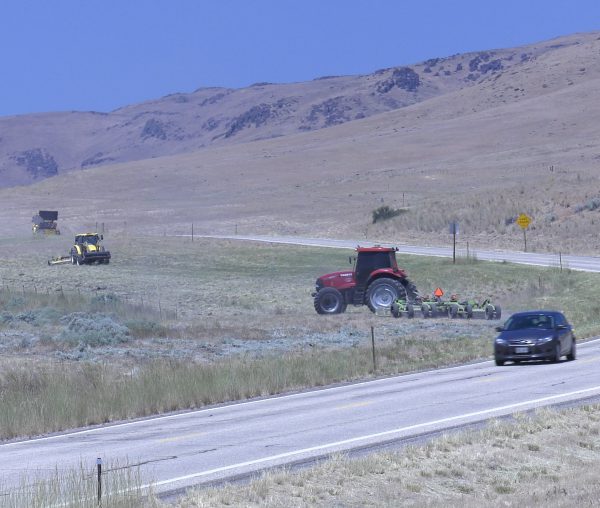
ITD crews mow alongside U.S. 20 in Elmore County
The fuel reduction program began in 2013. Since that time, fires along the interstate have decreased in size by 95%. During that same time, the amount of traffic has increased by 30%. You can read the report on BLM’s website here.
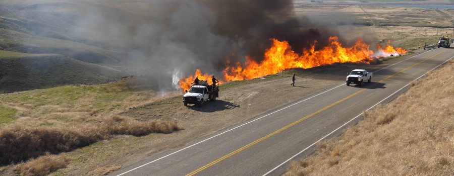
The program involved BLM identifying critical areas for vegetation growth alongside I-84 between Boise and Mountain Home. Working with ITD maintenance crews, these areas are treated with various methods. In some locations, additional gravel is placed beside the shoulder to lengthen the distance between fuels and potential fire starts from vehicles. ITD maintenance crews will mow alongside highways to reduce available fuel. In some instances, BLM crews will conduct controlled burns to eliminate built-up vegetation. The video below captures this work.
“The partnership with BLM has been very good for the traveling public,” said Carl Vaughn, ITD foreman out of Mountain Home. “We’ve seen few fires along I-84, which means fewer road closures. We’ve knocked down barriers between the federal agency and our own to the benefit of the people we’re here to serve.”
You can do your part to prevent human caused wildfires along the roadway. Before you leave on your next trip, check beneath your vehicle and make sure nothing is dragging close to the ground. If towing, ensure safety chains are not dragging. Don’t park your vehicle in tall or dry grass, where contact with a hot part can cause a fire start. For more safety tips, visit idahofireinfo.com.
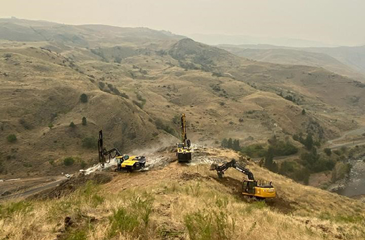
The Idaho Transportation Department (ITD) starts the blasting portion of the Idaho Highway 55 Smiths Ferry project Monday, September 21.
Drivers can anticipate the fall road closure schedule of Monday through Thursday, 10 a.m. to 2 p.m. to begin Monday. If motorists need to travel during this time frame, they are encouraged to plan around this schedule or use US-95. These closures will continue through mid-November when construction will pause for the winter months.
Crews will work during the closures to safely blast and remove rock from the canyon to widen the roadway between Smiths Ferry and the Rainbow Bridge. Large equipment, including steel containers and temporary barrier to prevent falling rock from entering the travel lane, and protect the crews working next to traffic in the narrow work zone, will fill one lane. As a result, drivers can expect one-way, alternating traffic when blasts are not being conducted. Motorists can find additional details on ITD’s project website.
“For the safety of our crews and travelers, please plan for the road to be closed every Monday through Thursday from 10 a.m. to 2 p.m. until this winter when construction will pause,” Vince Trimboli, ITD Communications Manager said. “We appreciate the public’s patience during the project as we make these much needed safety improvements.”
As a reminder, seasonal closures and traffic patterns will be as follows:
Fall (September – November): One-way alternating traffic; daytime and nighttime work, seven days a week; full road closures Monday – Thursday from 10 a.m. – 2 p.m.
Winter (December – Mid-March): No construction expected; all lanes open
Spring (Mid-March – Mid-May): One-way alternating traffic; daytime and nighttime work, seven days a week; full road closures Monday – Thursday from 10 a.m. – 2 p.m.
The project is expected to be completed by late fall 2022. Motorists are encouraged to sign up for text and email alerts to get the most up-to-date information on the project.
In the event of an emergency, ITD and emergency service providers have a system in place to allow vehicles through the work zone so they can transport patients or respond to other emergencies in a safe, timely manner.
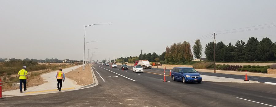
The Idaho Transportation Department has opened four lanes of Chinden Boulevard from Idaho Highway 16 to Linder Road to traffic, marking a major milestone in the ChindenWest Corridor project.
The widening of this section of Chinden Boulevard from two lanes to four began this spring. It will ensure the safety and mobility of the traveling public ahead of new development in the area. The new roadway includes four 12-foot travel lanes, two in each direction, and a detached 10-foot pathway to the south for bicyclists and pedestrians.
“Credit for this project’s success goes to the great partnership of everyone involved,” said Jayme Coonce, Engineering Manager for ITD District 3. “To reach this milestone, we needed the hard work and support from the City of Meridian, the developer, the Ada County Highway District, and our contractor, Idaho Materials and Construction.”
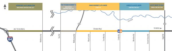
As this three mile section reopens to typical highway conditions, Locust Grove to Eagle Road prepares for a significant traffic shift, beginning Sept. 21, that will eliminate one through lane, both east and westbound, at the Eagle intersection (see graphic below).
“At the east end of the ChindenWest corridor, paving operations will be occurring between Locust Grove and Eagle Road,” said Michael Lucas, ITD’s project manager for this section. “The necessary lane shift may result in increased congestion during peak drive times. We encourage motorists to consider alternate routes when possible and appreciate everyone’s patience.”
The two-mile segment between Linder Road and Locust Grove Road is underway with the most significant construction activities scheduled for 2021.
The ChindenWest Corridor is a vital east-west connection in the heart of the Treasure Valley. The construction will add travel lanes, widen shoulders, and build a separated path parallel to the roadway.
The project website, ITDprojects.org/ChindenWest, serves as a hub of information for the public, including videos that provide a window into the future. The one-stop-shop website includes detailed information about construction activities, anticipated traffic impacts, and the improvement designs.
BOISE– The results are in and after a statewide enforcement and awareness effort to buckle up, participating officers issued 1,265citations for seat belt violations.
In Idaho, the seat belt use rate is 85%. The mobilization efforts exist for the remaining 15% who still don’t buckle up. In the last five years, from 2015-2019, 56 percent of vehicle occupants killed in Idaho were not restrained and 1,207 unrestrained vehicle occupants were critically injured in traffic crashes.
“Despite major advancements in vehicle protection, the most effective way to reduce serious injury or fatalities in crashes still remains the simplest task of all: wearing a seat belt,” saidHighway Safety Grants Officer Josephine Middleton.
The mobilization launched July 25 and wrapped up August 7. Typically, theClick It or Ticket campaign runs in May, but given the downturn in traffic counts this spring due to COVID-19, the Office of Highway Safetyran the mobilization effort later in the summer when more carswere on the road.
“Even with the challenges of this year, many agencies found a way to make sure that Idahoans were buckled up when driving during the 100 Deadliest Days,” addedMiddleton.
BOISE – Commerce within Idaho has been improved as restrictions to most legal loads have been reduced for the 538-mile stretch of US-95 within Idaho, which travels through 13 counties from the Oregon Border north to the Canadian Border. This is the result of a multi-year effort by the Idaho Transportation Board, based on information from industry leaders on the need to allow greater ease of commerce on the highway.
US-95 is the state’s primary north-south route, and was established as one of the country’s first national highways in 1926.
Recent improvements to the highway, particularly between Council and Grangeville, have resulted in a reduction of restrictions to the route. Because of those improvements, the highway will now allow up to 53-foot trailers without a permit and permitted vehicle combinations up to 115 feet in overall length, with a 6.5-foot off tracking and weight limit of up to 129,000 lbs.
“These improvements allow all of US-95 to have the same legal and permitted requirements from one section to the next, thus increasing the safety, mobility and economic opportunity for commercial vehicles specifically, and all motorists in general,” said Idaho Transportation Board Chairman Bill Moad.
Previously, permitted vehicle combinations were only allowed in loads up to 95 feet long and a 5.5-foot off track — a 21% increase in allowable length and 18% increase in allowable off-tracking — allowing more freedom in the movement or goods and services while also maintaining a safe roadway.
Off-tracking refers to the different paths that the front and rear wheels take when cornering. The rear or trailer wheels will take a shorter path around the curve, corner or turn. Thus, the driver has to compensate for this by taking the curve, corner or turn wider. So, the 6.5-foot off-track is the difference in the path of the first inside front wheel and of the last inside rear wheel as the vehicle negotiates a curve.
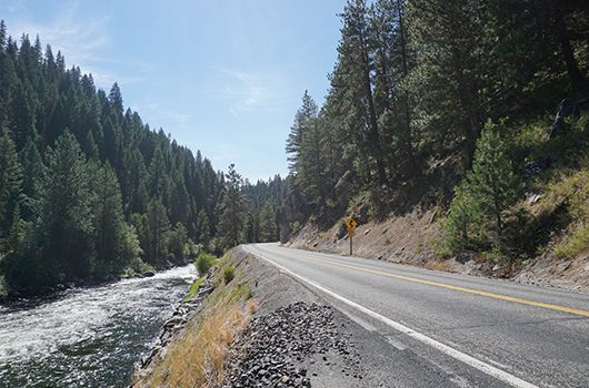
The Idaho Transportation Department (ITD) starts road work on the Idaho Highway 55 safety-enhancement project between Smiths Ferry and Round Valley on September 8.
The public is invited to attend a virtual public meeting on Wednesday, September 2, from 6 p.m. – 7 p.m. where ITD representatives will give an overview of the project and take questions. The link to attend will be posted on the project website, itdprojects.org/ID55smithsferry, 15 minutes prior to the meeting.
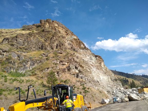
Work will largely be done in fall, spring and summer months, with construction stopping during the winter. This fall, travelers can expect full closures on the roadway Monday through Thursday from 10 a.m. – 2 p.m. to allow for blasting and rock removal.
Motorists can find additional details on road closures and traffic patterns on the project website, and can sign up for email and text updates.
“Our goal with this project is to enhance the safety of this mile-long section of the roadway,” Project Manager Alex Deduck said. “Construction crews will remove about 146,000 tons of rock from the hillside, which we want to do very carefully to not create rockslides or impact the river.”
Crews will work on widening shoulders and straightening the curves of the road. This project will also provide a smoother, safer ride for motorists by adding guardrail.
Motorists should anticipate reduced speeds and lanes reduced to one-way alternating traffic during construction. Seasonal closures and traffic patterns will be as follows:
Fall (September – November): One-way alternating traffic controlled by a temporary signal; daytime and nighttime work, seven days a week; full road closures Monday – Thursday from 10 a.m. – 2 p.m.
Winter (December – Mid-March): No construction expected; all lanes open
Spring (Mid-March – Mid-May): One-way alternating traffic controlled by a temporary signal; daytime and nighttime work, seven days a week; full road closures Monday – Thursday from 10 a.m. – 2 p.m.
Summer (Mid-May – August): One-way alternating traffic controlled by flaggers; daytime and nighttime work, Monday – Friday
The project is expected to be completed by late fall 2022. ITD and the Idaho State Police advise motorists to slow down and pay attention when driving in work zones, where increased speeding fines and other penalties apply. Motorists are encouraged to plan ahead and dial 5-1-1 or visit 511.idaho.gov for information on the state highway or interstate system.
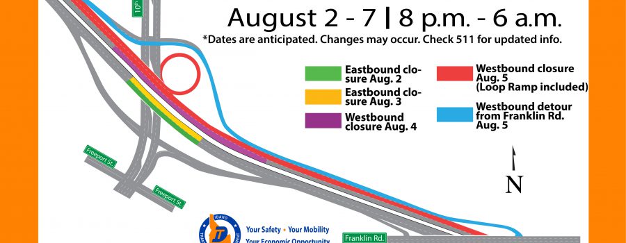
Starting the evening of Aug. 2, ITD maintenance crews will make repairs to the Interstate 84 bridge over 10th Ave in Caldwell to extend the life of the structure and provide a smoother driving surface.
Given the high volume of traffic on this section of I-84, work will only be done from 8 p.m. to 6 a.m. when traffic is at its lowest. A single lane of I-84 will be closed each night. Speed limits will be reduced. Repairs will first be made on the eastbound lanes, then the westbound lanes. Crews plan to finish repairs on one lane each night.
The graphic above describes the anticipated closure areas and which nights repairs will be made on the specific lanes.
Several potholes have formed on the pavement before and after the bridge deck, which maintenance crews filled with temporary patches. For the upcoming repairs, crews will chisel out these patches and place a smoother overlay of an epoxy material the length of the damaged area.
“This is a pretty extensive repair,” said Joe Hunter, ITD maintenance operator in Caldwell managing the project. “The patches work, but it’s a rough surface right now. When we’re done, things will be much smoother and the bridge will remain in acceptable condition.”
In addition to the single lane closures, area residents and businesses can anticipate increased noise and vibration from equipment.
ITD recently completed a long-range environmental evaluation of I-84 from Franklin Rd. to Centennial Way for additional lanes. The current proposal includes adding to the existing bridge structure to accommodate an additional eastbound and westbound lane. There is currently no funding available to construct those improvements. For more information about the environmental project, visit ITDprojects.org/i-84-caldwell-to-karcher.


